SUIZA · Neuchâtel
Swiss Canyon Trail 83 km: The Original 1996 Distance — Pre-Alpine Canyon Terrain, 3,491m D+, and the Fastest-Growing Field at the Swiss Canyon Trail Event
Datos clave
Distancia
83 km
Fecha
Precio de inscripción
140 CHF
€ / km
€1.85
Nueva fecha pendiente
Esta carrera ya ha tenido lugar. La fecha de la próxima edición está pendiente.
Technical Swiss Jura gorges: big early climbs, rocky singletrack, and a classic early-season ultra with an Absinthe-heavy past.
Swiss Canyon Trail 83 km is the 82.7km ultra at the Swiss Canyon Trail event in Val-de-Travers, Neuchâtel — one of the event's original distances, first run in 1996 under the Trail de l'Absinthe name, and the fastest-growing distance at the event with finishers up 44.4% between 2023 and 2025. The course climbs 3,491m D+ over 82.7km (42.2m per kilometre), ranking 252nd of 390 European trail races for vertical density — mid-spectrum and slightly less vertical per kilometre than the flagship 114.8km sibling. Terrain is Pre-Alpine and canyon: Swiss Jura ridges, Areuse gorge, and the same Chasseron summit (1,606m) shared with the 111K. Race starts at 6:00 AM from EspaceVal in Couvet with a 27-hour cutoff and a drop bag at Noirvaux base camp (km 45). Entry is 140 CHF standard (approximately €1.85 per kilometre); registration for the 2026 edition closed before race day — register early for 2027. Geneva Airport (GVA) is approximately 116 minutes from the start. ITRA 4 points.
Elevación y Terreno
Metros totales
3,491m
D+/KM
42.2m/km
Como referencia, el circuito Tor des Géants de 330 km tiene 73 D+/km.
Pendiente media de subida
11%
Pendiente media de bajada
-9.6%
Distribución del gradiente de subida
| 2–5% | 6.6 km | |
|---|---|---|
| 5–10% | 10.4 km | |
| 10–15% | 6.4 km | |
| 15–20% | 4.1 km | |
| 20%+ | 3.8 km |
Perfil de ruta
AnalysedDesglose del terreno
| 37.4% | Subida |
|---|---|
| 20.2% | Llano |
| 42.5% | Bajada |
Terreno
Ascensos

Principales ascensos
| Rank | Length | Elevation gain | Start km | Average gradient | Max gradient |
|---|---|---|---|---|---|
| 1 | 5.1 km · 735 m gain starts km 12 · avg 14.5% · max 25.5% | ||||
| 2 | 6.9 km · 674 m gain starts km 30 · avg 9.8% · max 47.6% | ||||
| 3 | 4.4 km · 288 m gain starts km 1 · avg 6.6% · max 24.6% |
Principales descensos
| Rank | Length | Elevation drop | Start km | Average gradient | Max gradient |
|---|---|---|---|---|---|
| 1 | 4 km · 605 m drop starts km 41 · avg -15.3% · max -45.4% | ||||
| 2 | 6.8 km · 494 m drop starts km 23 · avg -7.2% · max -32.4% | ||||
| 3 | 4.1 km · 336 m drop starts km 79 · avg -8% · max -35.7% |
Swiss Canyon Trail 83 km: The Original 1996 Distance — Pre-Alpine Canyon Terrain, 3,491m D+, and the Fastest-Growing Field at the Swiss Canyon Trail Event
Course Profile: 82.7km / 3,491m D+ at 42.2m per Kilometre — Canyon Terrain, Chasseron Summit, and a 6:00 AM Start from EspaceVal▼
Q: What is the course profile of Swiss Canyon Trail 83 km? A: Swiss Canyon Trail 83 km covers 82.7km (GPX-measured 83.6km) with 3,491m D+, equating to 42.2m per kilometre — ranking 252nd of 390 European trail races for vertical density. Terrain: Pre-Alpine and canyon — Swiss Jura ridges, Areuse gorge, rocky singletrack, and forest trail reaching the Chasseron summit at 1,606m (the same high point as the 114.8km sibling). Terrain breakdown: 37.4% uphill, 20.2% flat, 42.5% downhill. Average uphill gradient: +10.97% (rank 233/390). Average downhill gradient: -9.64% (rank 114/390 inverted — upper 29% for gentlest average descent). Top 3 climbs: 735m over 5.07km at +14.51% avg (starts km 12.21), 674m over 6.87km at +9.8% avg (starts km 30.24), 288m over 4.35km at +6.62% avg (starts km 1.35). Top single descent: 605m over 3.96km at -15.29% avg (starts km 40.59; rank 209/390). High point: Chasseron 1,606m. Low point: Noiraigue 715m. Start: 6:00 AM from EspaceVal, Couvet. Cutoff: 27 hours. Drop bag: Noirvaux base camp km 45. ITRA 4 points. Verify 2027 course details at swisscanyontrail.com/en/pages/81k.
The Original 1996 Distance, Now the Fastest-Growing: Why Swiss Canyon Trail 83 km Fills Up and What That Means for 2027 Registration▼
Q: What makes Swiss Canyon Trail 83 km the original distance, and does it sell out? A: Swiss Canyon Trail 83 km has run since 1996 — introduced under the Trail de l'Absinthe name and predating the event's flagship 114.8km ('111K') distance by 22 years (the 111K's Airtable first-year is 2018). The official site confirms the event has '30 years of history' as of 2026, with the 81K being one of the founding distances. The 83km is also the fastest-growing distance at the Swiss Canyon Trail event: finishers grew from 196 (2023) to 283 (2025), a 44.4% increase over two years — steeper growth than any other Swiss Canyon Trail distance researched [LOW CONFIDENCE figures; direction of growth is consistent]. Registration status: the 2026 edition closed before race day (Mae_Notes_May1826: 'Registration is closed'; SoldOutStatus: 'Other — See Notes'). This is a stronger signal than the ambiguous status field suggests — registration fills, and likely fills increasingly early as field growth continues. For 2027, register as soon as registration opens at swisscanyontrail.com — do not wait for mid-season. The 31K is the only confirmed closed-out distance on the research date; the 83km's closure status at that point is consistent with field capacity being reached.
D+/km Rank 252 of 390, Avg Uphill Rank 233 of 390 — Where Swiss Canyon Trail 83 km Sits in the European Ultra Spectrum▼
Q: How does Swiss Canyon Trail 83 km rank among European trail races for climbing difficulty? A: Among 390 European trail races, Swiss Canyon Trail 83 km ranks near the middle of the spectrum on all vertical metrics — slightly less extreme than the sibling 114.8km but consistent in profile. D+/km: 252/390 at 42.2m per km (251 races more vertical; 138 less vertical). Average uphill gradient: 233/390 at +10.97% (232 steeper; 157 gentler). Average downhill gradient INVERTED: 114/390 at -9.64% (rank 1 = gentlest; 113 gentler; 276 steeper — upper 29% for gentlest average descent). Top single ascent: 166/390 at 735m rise (rank 1 = largest). Top single descent: 209/390 at 605m drop (rank 1 = most dramatic). Percent-flat: 198/390 at 20.2% flat — near the center of the European ultra spectrum. Compared to the sibling Swiss Canyon Trail 115 km: the 83km is slightly less vertical (D+/km 252 vs 220), slightly gentler on average uphill (233 vs 226), and notably gentler on the top single descent (605m rank 209 vs 1,012m rank 114) — consistent with the two distances sharing the same opening course but diverging around km 40–45, with the 83km taking a shorter return.
Canyon Terrain, the Chasseron Ridge, and Early-Season Swiss Jura Weather: What to Expect on Swiss Canyon Trail 83 km▼
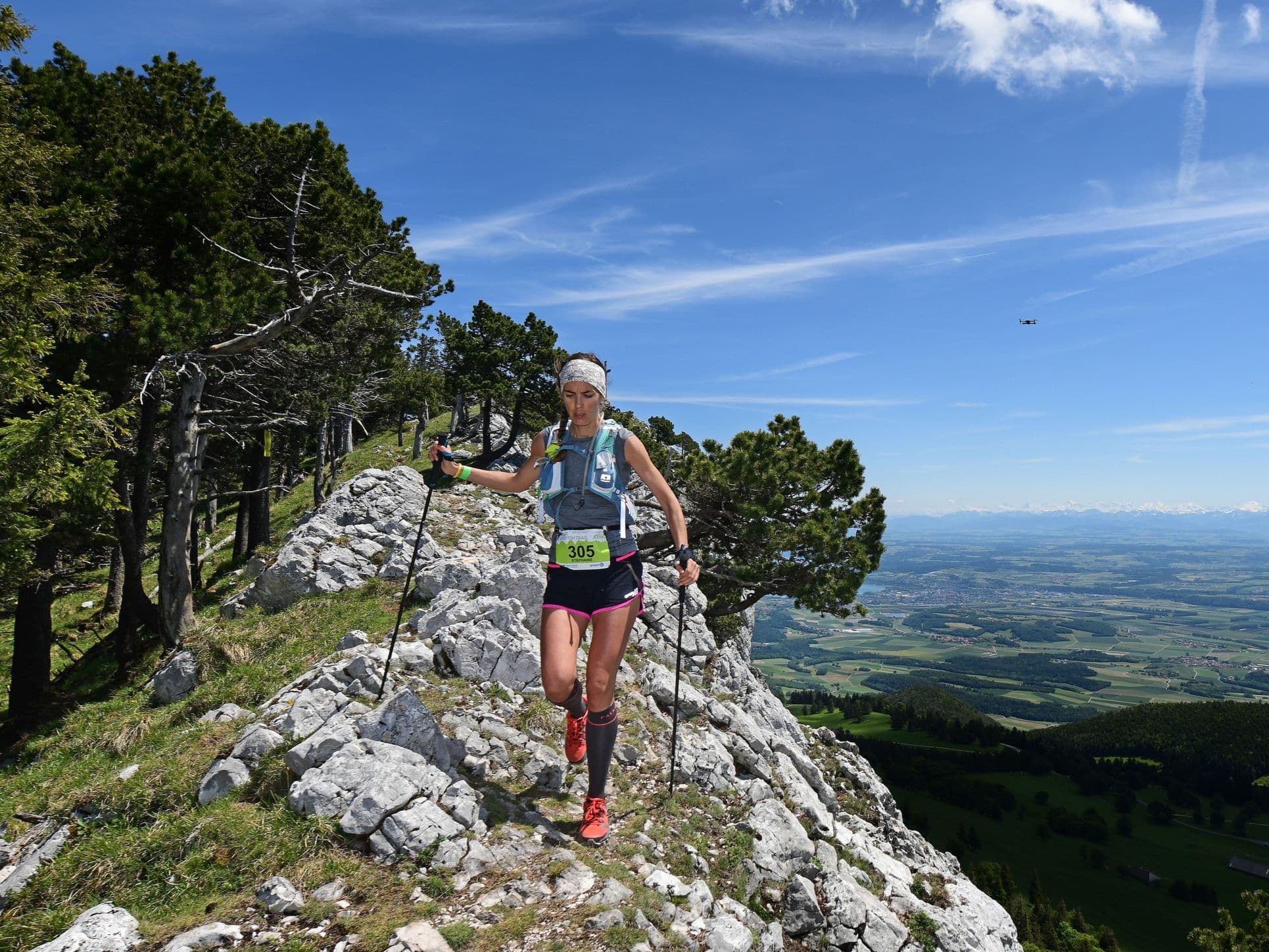
Q: What is the course setting and what conditions should runners expect at Swiss Canyon Trail 83 km? A: Swiss Canyon Trail 83 km runs through the Swiss Jura Pre-Alps in Val-de-Travers, Neuchâtel — canyon and gorge terrain defined by the Areuse river gorge, rocky singletrack, forest paths, and the Chasseron ridgeline at 1,606m. The course shares its opening ~30–40km with the 114.8km sibling before taking a different return route. Weather in late May is unpredictable: temperature ranges at race day have spanned from 1°C low (2022) to 25°C high (2026). The 2025 edition saw torrential overnight rain that turned the course's 3,491m of climbing into 'a real challenge' (The Ultrarunner.com, 2025) — flooded trails, mud, and exposed ridgelines under fog; the women's winner Sylvaine Cussot finished in 10:10 in full wet-weather conditions. Budget for cold, wet running and pack mandatory gear fully. Mandatory gear includes: ID card, eco cup, 1L+ water capacity, headlamp, mobile phone, survival blanket, whistle, waterproof jacket (10,000mm minimum — a windbreaker is explicitly insufficient per official rules), long-sleeved garment, trail pack, adhesive strip, and food reserve. Eight aid stations with hot pasta at the last three.
Archivos de carrera
Logística
Aeropuerto más cercano
Geneva (GVA) / Basel (BSL)
Notas
Start: ~2–2.5 hrs (GVA) or ~1.5–2 hrs (BSL) / Public transport: Feasible (train to region + local transfer); car still easier / Accommodation: Small-valley inventory; book early