Montenegro · Boka Kotorska (Kotor Bay)
Boka Bay Trail 83km: Night Start from the Adriatic, a 1,142m Opening Climb, and a Medieval City Finish in Kotor
Informations clés
Distance
83 km
Date
Droit d’inscription
75 EUR
€ / km
€0.90
Nouvelle date en attente
Cette course a déjà eu lieu. La date de la prochaine édition est en attente.
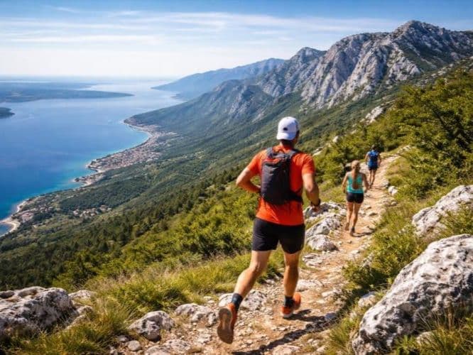
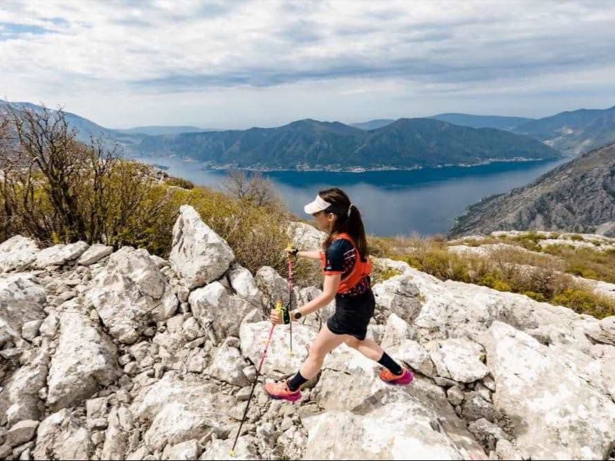
Bay-to-mountain contrast: Adriatic scenery into steep Balkan climbs around Kotor’s backyard.
The Boka Bay Trail Gray Course is an 83km point-to-point ultra running from the Adriatic coast at Herceg Novi to the medieval city walls of Kotor, tracing the full western and northern arc of the Bay of Kotor (Boka Kotorska) in Montenegro. The course covers 4,100m D+ (49.4 m/km) on a route that begins at sea level and tops out at 1,596m before descending into Kotor's UNESCO-adjacent Old Town. Terrain splits 42.1% uphill, 12.8% flat, and 45.1% downhill -- one of the lowest flat percentages in the DTR database, with almost no passive terrain across the full 83km. The race starts at 01:00 on Sunday April 26, 2026 from Port Skver in Herceg Novi -- a distinctive overnight departure that takes runners from harbour lights directly into the defining climb: a 9.81km ascent gaining 1,142m (11.64% average) beginning at km 0.09. This is the literal bay-to-mountain moment the race is built on. The final 8.97km drops 1,015m into Kotor at -11.31% average, finishing at the City Citadel in the Old Town. A race-organized bus transfers runners from Kotor to Herceg Novi the night before start. Racecheck rates the event 4.9/5 from 46 reviews with a Gold Award 2026 -- subcategory scores above 4.7 across all categories. The Gray Course is a boutique distance with a small field (17 finishers in 2025); introduced in 2024, it is only in its second or third year. Entry fee EUR 63-99 depending on timing (+5% processing fee). NOT FAR: Tivat Airport (TIV) is 21 minutes from the start area. The overall Boka Bay Trail event has run since 2021 across distances from 17km to 83km.
Élévation et Terrain
Mètres totaux
4,100m
D+/KM
49.4m/km
Pour référence, le Tor des Géants 330 km a 73 D+/km.
Pente montante moyenne
9.7%
Pente descendante moyenne
-9.1%
Distribution du gradient de montée
| 2–5% | 7.3 km | |
|---|---|---|
| 5–10% | 10.7 km | |
| 10–15% | 11.1 km | |
| 15–20% | 4.4 km | |
| 20%+ | 1 km |
Profil de parcours
AnalysedDétail du terrain
| 42.1% | Montée |
|---|---|
| 12.8% | Plat |
| 45.1% | Descente |
Terrain
Ascensions

Principales montées
| Rank | Length | Elevation gain | Start km | Average gradient | Max gradient |
|---|---|---|---|---|---|
| 1 | 9.8 km · 1142 m gain starts km 0 · avg 11.6% · max 21.1% | ||||
| 2 | 3.9 km · 450 m gain starts km 19 · avg 11.4% · max 17.5% | ||||
| 3 | 3.7 km · 436 m gain starts km 57 · avg 11.9% · max 21.4% |
Principales descentes
| Rank | Length | Elevation drop | Start km | Average gradient | Max gradient |
|---|---|---|---|---|---|
| 1 | 9 km · 1015 m drop starts km 73 · avg -11.3% · max -25.9% | ||||
| 2 | 6.4 km · 516 m drop starts km 40 · avg -8.1% · max -20.3% | ||||
| 3 | 6.6 km · 428 m drop starts km 26 · avg -7% · max -9.4% |
Boka Bay Trail 83km: Night Start from the Adriatic, a 1,142m Opening Climb, and a Medieval City Finish in Kotor
From Sea Level to 1,596m in 10km -- The Opening Climb That Defines the Gray Course▼
Q: What is the Boka Bay Trail Gray Course 83km? A: The Boka Bay Trail Gray Course is an 83km point-to-point trail ultra running from Port Skver in Herceg Novi to the City Citadel in Kotor's Old Town, Montenegro. The course covers 4,100m D+ (49.4 m/km) and connects two of the Adriatic coast's most distinctive cities via the mountain terrain surrounding the Bay of Kotor. It starts at 01:00 (overnight) and runs through dawn, with runners reaching the 1,596m high point during the night or early morning. The Gray Course was introduced in 2024; the overall Boka Bay Trail event has run since 2021 across distances from 17km to 83km. Racecheck rating: 4.9/5 from 46 reviews, Gold Award 2026. Entry fee EUR 63-99 (+5% processing). NOT FAR: Tivat Airport (TIV) is 21 minutes from the start. Next edition: April 24-25, 2027.
Kotor to Herceg Novi at Midnight -- The Bus Transfer, 01:00 Start, and Bay-to-Mountain Arc▼
Q: How hard is the Boka Bay Trail 83km? A: The course is sustained and demanding, particularly in the opening section. 4,100m D+ over 83km (49.4 m/km); DW average uphill 9.72% (LOWER-MID tier, approaching MID); DW average downhill -9.14% (LOWER-MID tier). Only 12.8% of the course is flat -- near the minimum in the DTR database, meaning almost no passive terrain across 83km. The defining challenge is the opening climb: 9.81km gaining 1,142m (11.64% average) starting at km 0.09, in darkness at 01:00, directly from the Herceg Novi harbour. The final 8.97km drops 1,015m into Kotor at -11.31% average. All three major climbs average 11-12% -- consistent and sustained rather than explosively steep (20%+ band is only 0.96km total). Racecheck reviewers rate it 76% Hilly and 37% Very challenging. The 01:00 overnight start and coast-to-alpine temperature swings add logistics complexity.
4,100m D+ at 49.4 m/km -- Course Profile, Gradient Analysis, and What to Expect▼
Q: What is the Boka Bay Trail start and route logistics like? A: The race is point-to-point from Herceg Novi to Kotor, so runners start and finish in different cities. The race organizers provide a bus transfer from Kotor to Herceg Novi on the Saturday night before the race (23:00 departure; EUR 10 reservation fee). Bib pickup is in Kotor on Saturday April 25 (17:00-20:00 at Omladinski klub), then again at the Herceg Novi start area from 23:30-00:45. The race starts at 01:00 from Port Skver, Herceg Novi and finishes at the City Citadel, Old Town Kotor. 8 aid stations are placed across the course at approximately 10-12km intervals. Mandatory gear includes headlamp, emergency blanket, hydration pack, and basic first aid. The start package includes a dry-fit T-shirt, chip timing, course marking, rescue team, aid stations, finisher medal, and a hot meal at the finish. Registration is transferable to the following year if the event is cancelled.
Racecheck Gold 4.9/5 -- What 46 Runners Say About Boka Bay Trail▼
Q: What do runners say about Boka Bay Trail -- and what is the Racecheck rating? A: Boka Bay Trail holds a 4.9/5 Racecheck rating from 46 reviews across all editions, with a 4.86/5 specifically in 2026 and a Gold Award 2026. Subcategory scores are consistently high: Supporting Staff (4.93), Finish Area (4.93), Event Logistics (4.91), Event Safety (4.91), Swag (4.91), Pre-event communication (4.85), Course Congestion (4.85), Sustainability (4.80), Course Navigation (4.78), Aid Stations (4.76). Reviewer characterizations: 76% describe the course as Hilly, 61% Large Festival Atmosphere, 50% Urban and Nature Mix, 37% Very challenging. An independent race report from Boundless Montenegro (33km edition) describes the race as one of the most rewarding despite punishing climbs, searing heat, and a cramping-and-knee-concern type effort, set against stunning coastal and mountain scenery with strong local support.
Fichiers de course
Logistique
Aéroport le plus proche
Tivat (TIV) / Dubrovnik (DBV) / Podgorica (TGD)
Notes
Start: ~10–20 min (TIV) to Tivat Porto Montenegro start area; ~1.5–2.5 hrs (DBV) with border; ~1.5–2.5 hrs (TGD) / Public transport: buses possible along the bay; race-day timing easier with taxi/car / Accommodation: strong in Tivat Kotor Herceg Novi; book early (April)