FINLANDE · Lapland (Utsjoki area)
Kaldoaivi Ultra Trail 168km: The World's Most Northern Ultra, Measured
Informations clés
Distance
168 km
Date
Droit d’inscription
279 EUR
€ / km
€1.66
Nouvelle date en attente
Cette course a déjà eu lieu. La date de la prochaine édition est en attente.
Far-north solitude: endless tundra singletrack, big sky, and true wilderness logistics above the Arctic Circle.
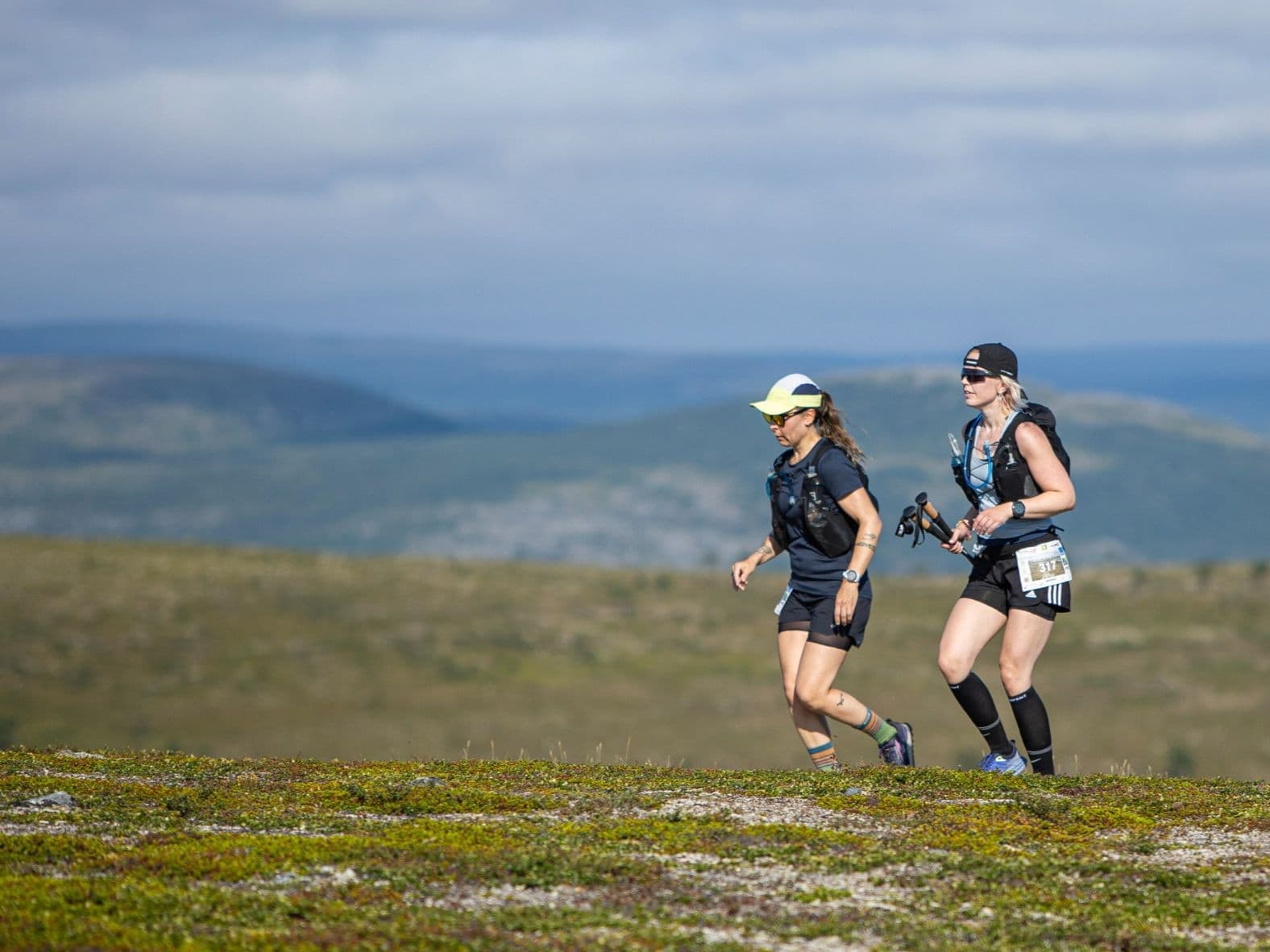
Kaldoaivi Ultra Trail 168 km is a trail race held on July 23–24, 2026, starting from Njallavaara in Utsjoki — Finland's northernmost municipality, above the Arctic Circle — traversing the Kaldoaivi Wilderness Area, Finland's largest and most northerly protected wilderness. The course covers 168 km with 2,450 m of gain (14.6 m/km) across open Arctic tundra, fell plateaus, and three river crossings, with approximately 22 hours of continuous daylight throughout. This is not a mountain race: the DW average uphill gradient is 5.4% and the biggest single climb rises just 188m. The challenge is 168 km of unrelenting forward movement through open wilderness with no shelter, no crowds, and no roads. The 2025 edition had approximately 28 finishers. Entry costs approximately €299 (~€1.78/km at current pricing). Ivalo (IVL) airport is 2.5–3.5 hours by road — accommodation in this remote corner of Finnish Lapland requires early planning. Described as the world's most northern ultra race, it suits self-sufficient ultra runners drawn to extreme solitude, midnight sun conditions, and a race where the wilderness itself is the opponent — not the gradient.
Élévation et Terrain
Mètres totaux
2,450m
D+/KM
14.6m/km
Pour référence, le Tor des Géants 330 km a 73 D+/km.
Pente montante moyenne
5.4%
Pente descendante moyenne
-5.5%
Distribution du gradient de montée
| 2–5% | 27.3 km | |
|---|---|---|
| 5–10% | 18.2 km | |
| 10–15% | 3.3 km | |
| 15–20% | 0.7 km | |
| 20%+ | 0 km |
Profil de parcours
AnalysedDétail du terrain
| 29.4% | Montée |
|---|---|
| 41.8% | Plat |
| 28.8% | Descente |
Terrain
Ascensions

Principales montées
| Rank | Length | Elevation gain | Start km | Average gradient | Max gradient |
|---|---|---|---|---|---|
| 1 | 1.7 km · 188 m gain starts km 0 · avg 10.8% · max 16.2% | ||||
| 2 | 5.1 km · 183 m gain starts km 68 · avg 3.6% · max 19.1% | ||||
| 3 | 5.8 km · 97 m gain starts km 19 · avg 1.7% · max 11.1% |
Principales descentes
| Rank | Length | Elevation drop | Start km | Average gradient | Max gradient |
|---|---|---|---|---|---|
| 1 | 2.3 km · 217 m drop starts km 162 · avg -9.6% · max -25.9% | ||||
| 2 | 5.1 km · 183 m drop starts km 37 · avg -3.6% · max -22.3% | ||||
| 3 | 7.9 km · 143 m drop starts km 47 · avg -2% · max -13.1% |
Kaldoaivi Ultra Trail 168km: The World's Most Northern Ultra, Measured
Why Kaldoaivi 168km Is Not a Mountain Race (14.6m/km, Zero Steep Climbing — and That's the Point)▼
Q: How hard is the Kaldoaivi Ultra Trail 168km? A: Uniquely demanding — but not in the way most mountain ultras are. The course has just 2,450m of gain over 168km (14.6 m/km), with a 5.4% average uphill gradient and no steep climbing at all. The difficulty is purely distance, self-sufficiency, and wilderness: 168km through open Arctic tundra with three river crossings, no shelter, minimal support, and potential strong winds and rain. The 2025 edition had approximately 28 finishers. Midnight sun conditions mean there is no natural night to use as a psychological reset.
Course Profile — 168km of Arctic Tundra, Three River Crossings, and 22 Hours of Daylight▼
Q: Is Kaldoaivi Ultra Trail an ITRA qualifier? A: Yes — the 168km is ITRA-certified. Check current ITRA and UTMB Index listings for point values and qualifying status.
Getting There: Ivalo Airport, Finnish Lapland Logistics, and Why Planning Early Matters▼
Q: Which airport should I use for Kaldoaivi Ultra Trail? A: Ivalo (IVL) is the nearest airport — approximately 2.5–3.5 hours by road to Njallavaara. Public transport is very limited; a long-distance bus to Utsjoki plus a taxi is possible but slow. A rental car or organised transfer is strongly recommended. Book accommodation in advance — Utsjoki has very limited capacity in July.
Fichiers de course
Logistique
Aéroport le plus proche
Ivalo (IVL)
Notes
Start: ~2.5–3.5 hrs drive (depending on exact start/finish) / Public transport: limited; long-distance bus possible to Utsjoki + taxi / Accommodation: sparse in far-north villages; book early and plan transfers carefully

FAR
It’ll possibly take 3+ hours from the closest large airport to arrive. Plan your adventure accordingly, take an extra day for those after-race beers or Curranz.