North Macedonia · Ohrid & Galicica National Park
Ohrid Ultra-Trail®
Distance
42 km
Date
May 22, 2026
Entry fee
42 EUR
€ / km
€1.00
New date pending
This race has already occurred. A new date for next year’s edition is pending.
Lakeside-to-mountain Macedonia: big climbs above Ohrid with Balkan heat and dramatic views.
Elevation and Terrain
Total Meters
1950m
D+/KM
46.43m/km
For context, the Tor des Géants 330 loop has 73 D+/km.
Avg Uphill Gradient
5.6%
Avg Downhill Gradient
-4.5%
Uphill gradient distribution
Route Profile
Analysed 2026-05-02Terrain breakdown
Terrain
Climbs

St. Naum Monastery to Ohrid Town Square -- Course Character and the Galicica National Park Traverse
Q: What is the Ohrid Ultra-Trail Samotska Trail 42km? A: The Samotska Trail is the 42km distance of the Ohrid Ultra-Trail weekend, held annually in May in Ohrid, North Macedonia. The course starts at 08:30 from St. Naum Monastery on the southern lakeshore of Lake Ohrid (~695m elevation), climbs steeply through Galicica National Park with dual-lake views over Lake Ohrid and Lake Prespa, and finishes in Ohrid town square. Nominal distance: 42km / 1,950m D+ (Airtable); 2026 ITRA-measured: 41.23km / +1,641m. The course is set entirely within the UNESCO World Heritage landscape of Lake Ohrid. 8th edition in 2026 (event since 2020). 200-place cap, 11-hour time limit. UTMB 50K Index qualifying race. EUR 42 entry (early bird EUR 32). NOT FAR: OHD Airport 13 minutes from Ohrid.
UTMB Index Points, Europe Trail Cup, and Alpe Adria -- What the Samotska Trail Qualifies For
Q: How hard is the Ohrid Ultra-Trail 42km compared to the 105km? A: The official site describes the Samotska Trail 42km as a fast trail suitable for many trail runners -- positioning it as the approachable entry point to the Ohrid Ultra-Trail weekend. The 42km has an 08:30 daytime start (vs the 105km midnight start), a shorter 11-hour time limit relative to the 105km cutoffs, and a 200-place cap (vs the 105km's larger field). Nominal elevation: ~1,950m D+ over 42km (~46.4 m/km) -- a meaningful mountain race by European standards. The 2026 ITRA-measured elevation was lower (+1,641m over 41.23km = 39.8 m/km), suggesting the 2026 course was a lighter edition. The course includes an initial steep climb phase, ridgeline running through Galicica National Park, and a descent into Ohrid. Experienced trail runners will find this a well-organized destination race at the moderate-challenging end of the 40km mountain category.
Fast Trail Suitable for Many -- What Makes the 42km Approachable and What Still Demands Respect
Q: What qualifications or circuit points does the Samotska Trail 42km offer? A: The Samotska Trail 42km is a UTMB 50K Index qualifying race, listed as Samotska Trail Marathon 40K on the UTMB Index. It also counts as a scoring race in the Europe Trail Cup circuit (europetrailcup.com) and the Alpe Adria Trail Cup circuit (alpeadria-trailcup.com). Both circuits include trail races across Southeastern and Central Europe; Ohrid is one of the southernmost and most distinctive venues on these calendars. ITRA 4 points are awarded for the 42km distance. The race is part of the same weekend as the 105km distance, which also provides circuit and index points.
UNESCO Setting, Dual-Lake Views, and Balkan Mountain Character -- The Ohrid Ultra-Trail Experience
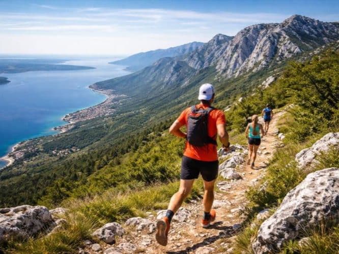
Q: What is the route and start of the Ohrid Ultra-Trail 42km like? A: The Samotska Trail starts at 08:30 from St. Naum Monastery on the southern shore of Lake Ohrid -- a culturally significant 10th-century Orthodox monastery set on the lakeshore, approximately 29km south of Ohrid town. The course follows the lakeshore before ascending steeply (a 5-8km climb) above the lake toward the Galicica National Park ridgeline. The ridge section offers dual-lake views over both Lake Ohrid and Lake Prespa simultaneously -- an unusual geographical feature unique to this part of North Macedonia. The course then descends to the finish in Ohrid town square. The race note: the official site URL uses 40k-en despite the distance being 41-42km in 2026 -- the 40K name is historical. Aid stations: approximately 4 across the course. The course runs through and around the UNESCO World Heritage Site designation covering both Ohrid town and Lake Ohrid.
Race files
Logistics
Nearest airport
Ohrid (OHD) / Skopje (SKP) / Tirana (TIA)
Notes
Start: ~10–25 min (OHD) to Ohrid; ~2.5–3.5 hrs (SKP) or ~3.5–5 hrs (TIA) by road / Public transport: buses from Skopje to Ohrid frequent; easy in town / Accommodation: strong in Ohrid (tourist city); book early in summer