France · Île-de-France
Distance
48 km
Date
Entry fee
€100
€ / km
€2.11
Ecotrail Paris 47.5 km: Point-to-Point from Versailles Palace to Pont d'Iena — D+/km Rank 356 of 390 and 93% Finisher Rate Make This One of Europe's Most Accessible Trail Ultras
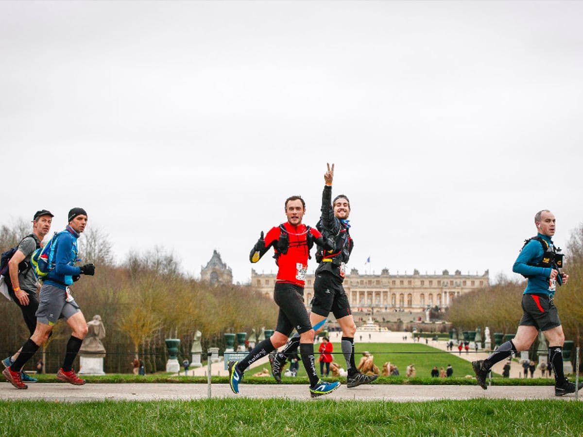
Ecotrail Paris 47.5 km is the 45 km Spring Trail at the Ecotrail Paris event — a point-to-point urban trail from the Gardens of the Chateau de Versailles to Pont d'Iena in Paris 16e, added to the event in 2010, two years after the founding 80 km distance. The 47.5km course climbs 800m D+ (16.8m per kilometre), ranking 356th of 390 European trail races for vertical density — among the 35 least vertically demanding ultras in the database. Percent-flat ranks 358/390, with 55.3% of the course on level terrain; 85% of the surface is nature trail despite running through Ile-de-France.
Race starts at 10:00-10:15 AM from the Versailles palace grounds, passing through Domaine de Saint-Cloud, with an 8h15 cutoff and a 93% finisher rate. Entry is EUR97 standard (approximately EUR2.04 per kilometre); the 2026 edition went to waitlist-only before race day — register early for 2027. Access is by RER C to Saint-Cyr station and a free shuttle to the start; Paris CDG Airport is 77 minutes from the event hub. UTMB Index qualifier. FFA Label Silver. 1,730 finishers in 2025.
Elevation and Terrain
Total Meters
800m
D+/KM
16.8m/km
For context, the Tor des Géants 330 loop has 73 D+/km.
Avg Uphill Gradient
6.6%
Avg Downhill Gradient
-6.4%
Uphill gradient distribution
| 2–5% | 5.0 km | |
|---|---|---|
| 5–10% | 3.1 km | |
| 10–15% | 1.1 km | |
| 15–20% | 0.4 km | |
| 20%+ | 0.3 km |
Route Profile
AnalysedTerrain breakdown
| 20.9% | Uphill |
|---|---|
| 55.3% | Flat |
| 23.8% | Downhill |
Terrain
Ecotrail Paris – 47.5 km 48km Top Climbs
Top Climbs
| 1 | 2.0 km · 93 m gain starts km 28 · avg 4.7% · max 24.8% |
|---|---|
| 2 | 1.7 km · 66 m gain starts km 13 · avg 3.9% · max 14.7% |
| 3 | 2.6 km · 58 m gain starts km 7 · avg 2.2% · max 16.1% |
Top descents
| 1 | 1.1 km · 92 m drop starts km 27 · avg -8.8% · max -15.2% |
|---|---|
| 2 | 0.9 km · 72 m drop starts km 20 · avg -7.8% · max -23.2% |
| 3 | 1.3 km · 69 m drop starts km 37 · avg -5.0% · max -9.0% |
Versailles to the Eiffel Tower: The Ecotrail Paris 47.5km Course Profile
What is the course profile of Ecotrail Paris 47.5 km?
▼
Ecotrail Paris 47.5 km is a point-to-point route of 47.5km with 800m D+ (16.8m per kilometre) from the Gardens of the Chateau de Versailles to Pont d'Iena in Paris 16e, passing through Domaine de Saint-Cloud. The course is 55.3% flat, 20.9% uphill, and 23.8% downhill. Average uphill gradient is +6.61%; average downhill gradient is -6.39% — smooth and non-technical throughout. The biggest single climb is 93m over 2.01km at km 27.60 (+4.65% average gradient); the biggest single descent is 92m over 1.05km at km 26.55 (-8.8% average gradient). The race starts at 10:00-10:15 AM from the Versailles palace grounds, with an 8h15 cutoff (finishing by approximately 6:15-6:30 PM) and a 93% finisher rate. Surface is 85% nature trail. No headlamp is required — this is a fully daylight race.
One of Europe's Flattest Ultras: Who Ecotrail Paris 47.5km Is Built For
What is Ecotrail Paris 47.5 km like to run and who is it for?
▼
D+/km rank 356/390 and pct-flat rank 358/390 place Ecotrail Paris 47.5 km among the 35 least vertically demanding ultras in DTR's database of 390 European trail races. In practice this means a race that demands endurance and pacing discipline rather than technical mountain skills — the challenge is maintaining a consistent pace over 47.5km of rolling Ile-de-France terrain, not managing steep gradients or exposed ridgelines. The 93% finisher rate reflects this accessibility. The race is officially positioned as the natural next step for finishers of the 30km Trail and as an ideal transition for marathon runners moving to trail running. Mandatory gear is minimal: 1 litre water reserve, food reserve, eco cup, survival blanket, charged mobile phone, and photo ID — no headlamp or reflective armband required, consistent with an all-daylight start. 1,730 runners finished the 2025 edition.
How Ecotrail Paris 47.5km Ranks Against European Ultras
How does Ecotrail Paris 47.5 km rank against other European ultras?
▼
Across six DTR ranking metrics for 390 European trail races, Ecotrail Paris 47.5 km sits near the bottom of the vertical-demand scale: D+/km rank 356/390 (35th lowest vertical density in Europe), pct-flat rank 358/390 (33rd most flat), average uphill gradient rank 350/390 (+6.61% weighted average), and top single ascent rank 343/390 (93m at +4.65% average). The average descent profile ranks 39/390 on the inverted scale (rank 1 = gentlest), meaning only 38 of 390 European trail races have smoother average descents — consistently non-technical terrain throughout. The top single descent ranks 345/390 (92m at -8.8% average). GPX formula_gain_dev_pct = +0.01625 (GPX overestimates official D+ by 1.6% — the tightest data match of the Ecotrail Paris distance family, confirming reliable course mapping).
Urban Trail Character and Setting of Ecotrail Paris 47.5 km: Versailles to the Eiffel Tower
What is the terrain and setting like on Ecotrail Paris 47.5 km?
▼
Ecotrail Paris 47.5 km starts in the formal gardens of the Chateau de Versailles — a UNESCO World Heritage Site — and finishes at Pont d'Iena, the bridge at the foot of the Eiffel Tower in Paris 16e. The middle section passes through Domaine de Saint-Cloud, a 460-hectare wooded estate on the western edge of Paris, keeping 85% of the course on nature surface despite running entirely within Ile-de-France. The route runs broadly west-to-east from the historic royal suburbs through forested estates into the city, crossing the Seine valley before finishing on the Paris riverfront. Despite the urban setting, the terrain is consistently rolling and forest-edged — the course does not feel like a road race. March conditions in Ile-de-France are typically cool (5-12 degrees C) with a realistic chance of rain; the 10:00 AM start means the entire race happens in daylight.
Versailles Start, RER C Access, and Registration for Ecotrail Paris 47.5km
How do I enter Ecotrail Paris 47.5 km and get to the start?
▼
Ecotrail Paris 47.5 km starts at 10:00-10:15 AM from the Gardens of the Chateau de Versailles, accessible by RER C to Saint-Cyr station followed by a free shuttle bus to the start area. Paris CDG Airport is approximately 77 minutes from the event hub; Paris ORY is also viable. The race finishes at Pont d'Iena in central Paris, easily reached by Metro and RER for return journeys. Entry is EUR97 standard (approximately EUR2.04 per kilometre); the 2026 edition went to waitlist-only before race day. For 2027, register as early as possible after registration opens — the sold-out pattern is consistent across all Ecotrail Paris distances. Bib pickup is Thursday/Friday before race day at Centre sportif Emile Anthoine in Paris. UTMB Index qualifier (20K/50K/100K tiers). FFA Label Silver.
Ecotrail Paris – 47.5 km 48km GPX
Getting to Ecotrail Paris – 47.5 km
Nearest airport
Paris CDG (CDG) / Paris Orly (ORY)
Notes
Start: <1 hr / Public transport: Excellent (metro/RER)