Austria · Salzburg
Distance
110 km
Date
Entry fee
—
€ / km
—
Grossglockner Ultra-Trail 110km: Austria's Highest Peak and Europe's 6th Biggest Descent
The Grossglockner Ultra-Trail (GGUT 110) is a 110 km trail race held in July in Salzburg province, Austria. The course gains 6,500 m over 110 km (59.1 m/km), starting at 9:30 pm on a Friday from Kaprun and circumnavigating the Grossglockner — Austria's highest mountain at 3,798 m — through the Hohe Tauern National Park. Entry costs €220 (until May 31, 2026), equivalent to €2.00 per kilometre. The race sells out each year.
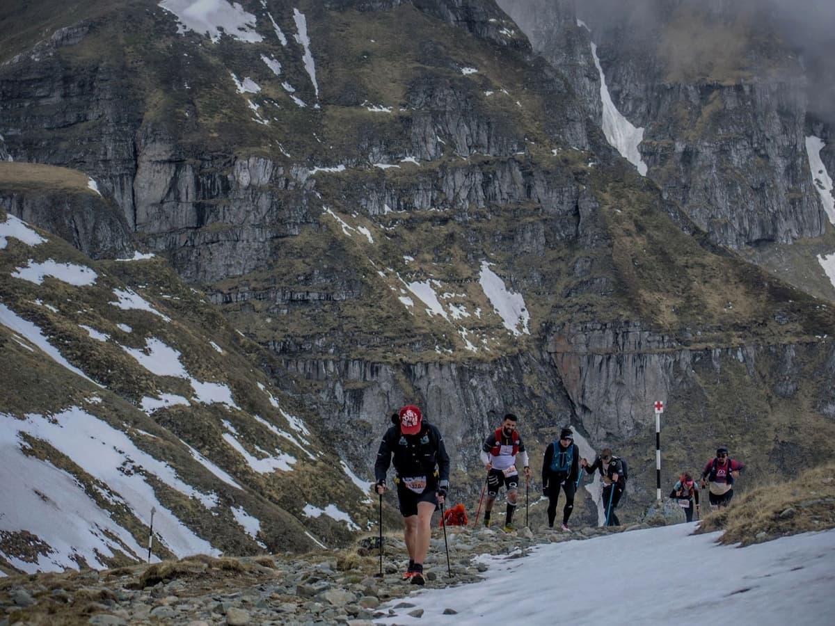
The longest descent drops 1,792 m over 17.4 km — the 6th largest single descent of 386 European trail distances in the DTR database. The distance-weighted average uphill gradient of 17.3% ranks 23rd steepest of 390 European distances — meaning nearly 9 in 10 European trail races are less steep on uphills. The route crosses 3 federal states, 7 valleys, and passes 14 glaciers. Over half the course runs above 2,000 m. Nearest airport is Salzburg (SZG), 81 minutes by car.
First run in 2015, the North Face-sponsored GGUT carries 5 ITRA points and qualifies for the Western States 100 lottery with finishes under 28 hours. Maximum field is 500 runners. It suits qualified trail runners prepared for serious alpine attrition — the 2025 edition was abandoned mid-race due to bad weather.
Elevation and Terrain
Total Meters
6,500m
D+/KM
59.1m/km
For context, the Tor des Géants 330 loop has 73 D+/km.
Avg Uphill Gradient
17.3%
Avg Downhill Gradient
-15.8%
Uphill gradient distribution
| 2–5% | 7.4 km | |
|---|---|---|
| 5–10% | 9.1 km | |
| 10–15% | 6.2 km | |
| 15–20% | 4.2 km | |
| 20%+ | 13.6 km |
Route Profile
AnalysedTerrain breakdown
| 38.0% | Uphill |
|---|---|
| 20.4% | Flat |
| 41.6% | Downhill |
Terrain
Grossglockner Ultra-Trail – 110 km 110km Top Climbs
Top Climbs
| 1 | 4.3 km · 770 m gain starts km 50 · avg 18.1% · max 123.8% |
|---|---|
| 2 | 5.5 km · 736 m gain starts km 56 · avg 13.3% · max 51.0% |
| 3 | 3.8 km · 660 m gain starts km 69 · avg 17.6% · max 93.3% |
Top descents
| 1 | 17.4 km · 1,792 m drop starts km 74 · avg -10.3% · max -81.1% |
|---|---|
| 2 | 3.8 km · 583 m drop starts km 32 · avg -15.5% · max -79.4% |
| 3 | 4.1 km · 548 m drop starts km 24 · avg -13.0% · max -70.5% |
How hard is the GGUT 110km? (Climbs, descents, and GPX data breakdown)
How hard is the Grossglockner Ultra-Trail GGUT 110km?
▼
Very hard. The GGUT covers 110km with 6,500m of elevation gain (59.1m per km) within a 28-hour cutoff. The distance-weighted average uphill gradient of 17.3% is the 23rd steepest of 390 European distances — steeper on uphills than nearly 9 in 10 European trail races. The longest descent drops 1,792m over 17.37km — the 6th largest single descent of 386 European trail distances. Over half the route runs above 2,000m, with 2–4 snowfield crossings and via ferrata sections on cliff faces. The 2025 edition was abandoned mid-race due to bad weather.

Does the Grossglockner Ultra-Trail qualify for Western States 100?
Does the Grossglockner Ultra-Trail qualify for Western States 100?▼
Yes. The GGUT 110km is a qualifier for the Western States 100 Endurance Run for runners finishing under 28 hours — the race's full time limit. It also carries 5 ITRA points (the maximum), making it one of the most ITRA-point-dense 110km races in Europe. Entry qualification requires completion of a race with ≥3 ITRA points between January 2023 and May 2026.
How to get to the Grossglockner Ultra-Trail from Salzburg airport
How do you get to the Grossglockner Ultra-Trail from Salzburg?
▼
Salzburg airport (SZG) is approximately 81 minutes by car from Kaprun, the race start and finish. Public transport connects via excellent train service to Zell am See and then bus to Kaprun. Munich (MUC) and Innsbruck (INN) airports are alternative options within 2–2.5 hours. Accommodation in Zell am See and Kaprun fills quickly — the area is a popular summer resort; book well in advance.
Abandoned Mid-Race in 2025: The Grossglockner Ultra-Trail — GGUT 110km's High-Alpine Weather Exposure
What is the weather risk on the GGUT 110km?
▼
High. The route runs above 2,000m for more than half its distance, with passes reaching 2,663m. The 2025 edition of the longer GGUT races was abandoned mid-race due to deteriorating weather. Sudden storms, snow, and near-freezing conditions at altitude are possible in late July. Mandatory bad-weather kit — hardshell jacket, waterproof trousers, thermal layers, hat and gloves — is carried by all runners. Equipment is checked at the start and at spot checks during the race.
How many ITRA points does the GGUT 110km earn?
How many ITRA points does the GGUT 110km earn?▼
The GGUT 110km earns 5 ITRA points — the maximum possible. Combined with its Western States 100 qualifier status (for finishers under 28 hours), it is one of the most credentialled independent 110km races in Europe. The race is not part of the UTMB World Series. Entry requires proof of ≥3 ITRA points from a race completed between January 2023 and May 2026.
Getting to Grossglockner Ultra-Trail – 110 km
Nearest airport
Salzburg (SZG) / Munich (MUC) / Innsbruck (INN)
Notes
Start: ~1.5–2.5 hrs to Kaprun/Zell am See / Public transport: very good (train to Zell am See + bus) / Accommodation: strong in Zell am See/Kaprun; book early (summer)