Switzerland · Bernese Oberland
Eiger Ultra Trail by UTMB
Distance
250 km
Date
July 15, 2026
Entry fee
598 CHF
€ / km
€2.61
New date pending
This race has already occurred. A new date for next year’s edition is pending.
UTMB in the Jungfrau: towering peaks, huge climbs, and high-alpine drama around Grindelwald.
Elevation and Terrain
Total Meters
18000m
D+/KM
72m/km
For context, the Tor des Géants 330 loop has 73 D+/km.
Avg Uphill Gradient
14.8%
Avg Downhill Gradient
-15.1%
Uphill gradient distribution
Route Profile
Analysed 2026-05-02Terrain breakdown
Terrain
Climbs

Top climbs
12.0 km · 1598 m gain
starts km 147 · avg 13.3% · max 61.8%
9.2 km · 1422 m gain
starts km 25 · avg 15.5% · max 51.6%
15.4 km · 1343 m gain
starts km 242 · avg 8.7% · max 72.7%
Top descents
13.2 km · 1679 m drop
starts km 83 · avg -12.7% · max -52.5%
10.9 km · 1596 m drop
starts km 44 · avg -14.6% · max -79.7%
23.5 km · 1461 m drop
starts km 214 · avg -6.0% · max -55.8%
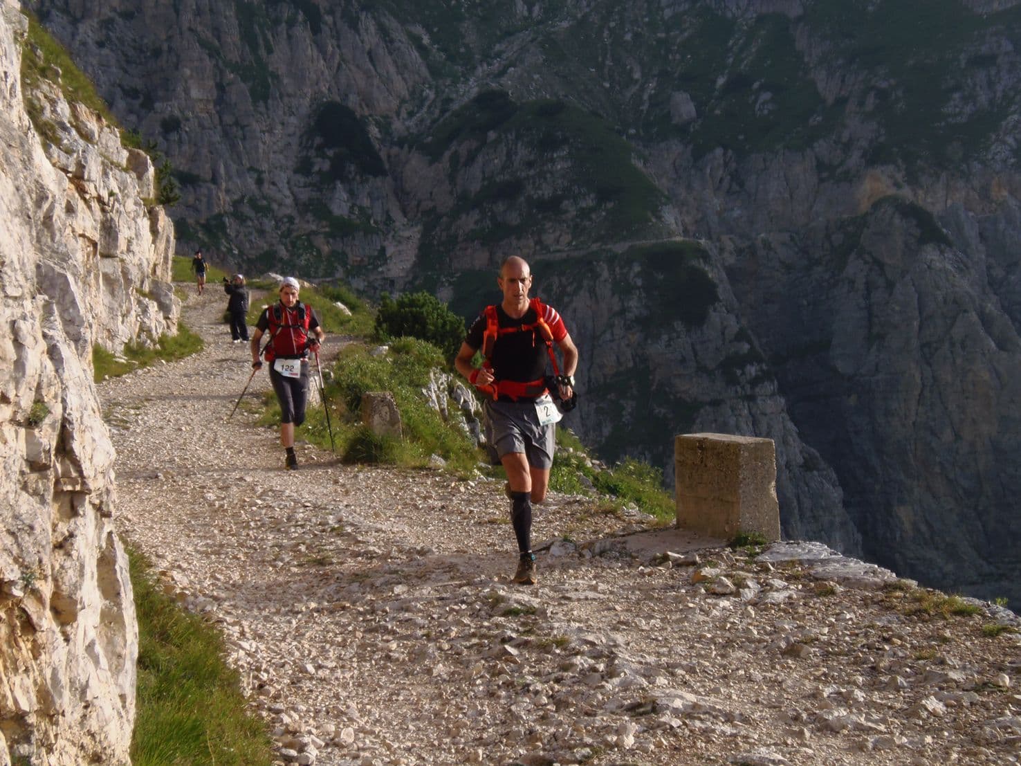
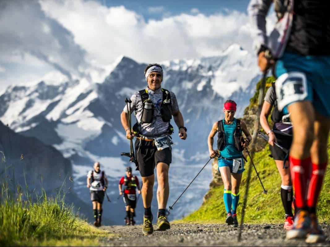
The Eiger Ultra Trail by UTMB E250 is a 250 km team trail race held in July in the Bernese Oberland, Switzerland. The course gains 18,000 m over 250 km (72 m/km), starting and finishing in Grindelwald, and circumnavigating the UNESCO World Heritage Swiss Alps Jungfrau-Aletsch site — nine 4,000 m peaks and the 23 km Aletsch glacier, the largest in the Alps.
Entry is by team only: 2 or 3 runners race together throughout with no solo entry permitted. Entry costs CHF 598.40 per runner (~€2.61/km), allocated by lottery — the 2026 edition is sold out.
The biggest descent drops 1,596 m over 10.95 km — the 10th largest single descent of 386 European trail distances in the DTR database. The biggest climb rises 1,598 m — the 20th largest single ascent of 385 European distances. 28.71 km of uphill terrain exceeds 20% gradient.
The route carries no markings; teams navigate entirely by GPS across glaciers, passes, and remote alpine valleys. Four life bases provide hot food and sleeping space.
Nearest airport is Zürich (ZRH), approximately 179 minutes by train. Now in its fourth edition in 2026, the E250 suits teams of experienced alpine runners seeking an expedition-style 100-hour challenge through a UNESCO World Heritage landscape.
How hard is the Eiger Ultra Trail E250? (Course profile, climbs, and GPX data)
Q: How hard is the Eiger Ultra Trail E250? A: Exceptionally hard. The E250 covers 250km with 18,000m of elevation gain (72m per km) within a 100-hour cutoff. The biggest descent drops 1,596m over 10.95km — the 10th largest single descent of 386 European trail distances tracked. The biggest climb rises 1,598m — the 20th largest single ascent. 28.71km of uphill terrain exceeds 20% gradient. The route carries no markings; teams navigate entirely by GPS across glaciers, high passes, and remote valleys. In 2024, the course ran 254km/14,945m after late snow and rockfalls modified the route just 48 hours before the start.
Why does the E250 require a team — and what does racing in a team mean in practice?
Q: Why is the E250 a team race? A: The team format was a deliberate choice by race director Ralph Naef — a mountain guide and search & rescue leader in Grindelwald. Swiss mountain infrastructure could not support a fully staffed 250km race at this scale; a team-only, GPS-navigated format made it logistically feasible. Teams of 2 or 3 runners race together throughout, supported by 4 life bases (hot food and sleeping space) and 10 aid stations. No solo entry is permitted. [Feature: Run the Alps / Doug Mayer, runthealps.com, 2021]
How do you qualify and enter the E250 lottery?
Q: How do you enter the Eiger Ultra Trail E250? A: Entry is by lottery only. The 2026 edition's lottery ran September 22–29, 2025, with results posted October 1 and confirmation required by October 6. The 2026 edition is sold out. Entry fee is CHF 598.40 (tier 1) or CHF 637.65 (tier 2) per runner, inclusive of VAT and a 10% processing fee. UTMB Running Stones qualification is likely required — confirm current threshold at eiger.utmb.world before applying. Maximum field is approximately 50 teams (~150 runners).
How to get to the Eiger Ultra Trail from Zürich airport
Q: How do you get to Grindelwald from Zürich airport? A: Zürich airport (ZRH) is approximately 179 minutes by train from Grindelwald — the standard route runs via Bern and Interlaken Ost. Geneva airport (GVA) is an alternative at a similar travel time via Bern. Grindelwald is a major Jungfrau region resort with excellent public transport connections; no car is needed. Accommodation fills early and prices are high — the Jungfrau region is one of Switzerland's most popular resort areas. Book several months ahead.
Race files
Logistics
Nearest airport
Zürich (ZRH) / Geneva (GVA) / Bern (BRN)
Notes
Start: ~2–3 hrs by train to Grindelwald (ZRH/GVA) / Public transport: excellent (train to Grindelwald) / Accommodation: strong but expensive in Jungfrau region; book early