POLONIA · Lower Silesian Voivodeship
Garmin Ultra Race Radków
Distancia
78 km
Fecha
September 11, 2026
Precio de inscripción
280 PLN
€ / km
€0.86
Sudetes trails + slick organization: punchy climbs, forest singletrack, and a modern Polish ultra scene.
Elevación y Terreno
Metros totales
2300m
D+/KM
29.49m/km
Como referencia, el circuito Tor des Géants de 330 km tiene 73 D+/km.
Pendiente media de subida
7.5%
Pendiente media de bajada
-7.0%
Distribución del gradiente de subida
Perfil de ruta
Analysed 2026-05-02Desglose del terreno
Terreno
Ascensos
Principales ascensos
5.0 km · 456 m gain
starts km 54 · avg 9.2% · max 38.4%
4.7 km · 406 m gain
starts km 1 · avg 8.6% · max 50.7%
1.2 km · 176 m gain
starts km 63 · avg 14.6% · max 34.1%
Principales descensos
2.5 km · 310 m drop
starts km 71 · avg -12.5% · max -35.7%
3.5 km · 304 m drop
starts km 47 · avg -8.7% · max -29.3%
1.8 km · 204 m drop
starts km 61 · avg -12.0% · max -35.6%
What Is the Stołowe Mountains Like to Race? (Rock Corridors, 50% Gradient Spikes, and Gentle Averages)
Q: How hard is the Garmin Ultra Race Radków 78km? A: Moderately demanding with technically challenging moments. The course covers 78km with 2,300m of gain (~29.5m/km) through the Stołowe (Table) Mountains. The average uphill gradient is 7.5% (gentle by database standards), but individual sections reach 50.7% maximum gradient through rock steps and tight gullies. Descents are described as 'very narrow and steep' in the rock formation passages. Time limit is 15 hours; the race starts at 05:00.
Course Profile — Labyrinth Rocks, Death Peak, and 78km Through the Polish Table Mountains
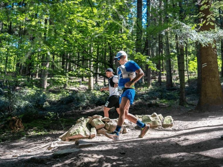
Q: What are the Stołowe Mountains and what makes the terrain distinctive? A: The Stołowe (Table) Mountains in Lower Silesia are unique in Europe — a sandstone plateau with dramatically eroded rock formations including Błędne Skały (Labyrinth Rocks), where runners navigate tight corridors between sheer rock walls, and Białe Skały (White Rocks). The terrain is not alpine but is technically demanding due to its tight passages, rock steps, and gully descents. The summit Kopa Śmierci (Death Peak) provides the course's high point.
€65 for a UTMB Qualifier in Southern Poland: The Garmin Ultra Race Value Case
Q: How much does the Garmin Ultra Race Radków 78km cost? A: Approximately 280 PLN (~€65 at current rates) — €0.86 per kilometre. Registration via startlist.pl adds a 2.5% service fee for online payments; choosing bank transfer at checkout avoids this surcharge.
Getting There: Wrocław Airport, Kłodzko, and Staying Near the Stołowe Mountains
Q: Is the Garmin Ultra Race Radków a UTMB qualifier? A: Yes — the race is a UTMB qualifying event as part of the Garmin Ultra Race series. It is also listed on ITRA; exact point values should be confirmed from the ITRA listing.
Archivos de carrera
Logística
Aeropuerto más cercano
Wrocław (WRO) / Prague (PRG)
Notas
Start: ~1.5–2.5 hrs to Radków (Stołowe Mountains) / Public transport: bus via Kłodzko to Radków possible; last-mile manageable / Accommodation: limited in Radków; better supply in Kudowa-Zdrój/Polanica-Zdrój; book early (summer)