Skip to content
Naturel Velebit Trail 160 km trail running route — Croatia · Zadar County

CROATIE · Zadar County

Naturel Velebit Trail 160km: Croatia's Pioneer 100-Miler — Founded 2003, Unmarked Course, Velebit Wilderness

Distance

160 km

Date

Droit d’inscription

100 EUR

€ / km

€0.63

📅

Nouvelle date en attente

Cette course a déjà eu lieu. La date de la prochaine édition est en attente.

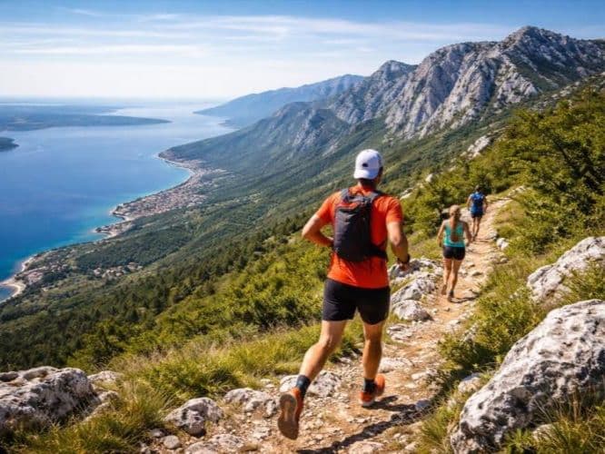
True Velebit wilderness: remote ridges, harsh karst, and an old-school 100-mile adventure.

Naturel Velebit Trail 160 km is a point-to-point mountain race from Starigrad Paklenica to Senj harbour on the Adriatic, starting at 08:00 on June 20, 2026. The course covers 160 km with 7,500 m of gain (~47 m/km) across the Velebit range — Paklenica National Park canyon, the high ridge including Vaganski vrh (1,757 m) at km 35, the iconic Premužić Trail (km 80–138), and a 22 km coastal descent to Senj. Distance-weighted average gradients are 13.65% uphill and 13.06% downhill; only 16.8% of the course is flat; 13.92 km sits above 20% incline. The course is not marked — runners navigate by GPS download throughout. Entry costs €100 (€0.625/km) plus a €60 mandatory GPS tracker deposit returned at the Senj finish. 56-hour time limit. Founded in 2003 — approximately two months before UTMB's inaugural edition — making it one of the oldest 100-mile trail events in the world. 24th edition in 2026. IS FAR: Zadar ZAD ~45 min.

Élévation et Terrain

Mètres totaux

7,500m

D+/KM

46.9m/km

Pour référence, le Tor des Géants 330 km a 73 D+/km.

Pente montante moyenne

13.7%

Pente descendante moyenne

-13.1%

Distribution du gradient de montée

Naturel Velebit Trail 160 km — uphill gradient distribution (GPX-derived, analysed 2026-05-02)
2–5%
13 km
5–10%
17 km
10–15%
11.8 km
15–20%
8.2 km
20%+
13.9 km

Profil de parcours

Analysed

Détail du terrain

Naturel Velebit Trail 160 km — terrain breakdown (GPX-derived, analysed 2026-05-02)
40.7%Montée
16.8%Plat
42.5%Descente

Terrain

AlpineCoastal

Ascensions

Naturel Velebit Trail climbs and descents profile

Principales montées

Naturel Velebit Trail 160 km — top climbs (GPX-derived, analysed 2026-05-02)
1

15.1 km · 1208 m gain

starts km 0 · avg 8% · max 64.5%

2

6.3 km · 913 m gain

starts km 20 · avg 14.4% · max 75.8%

3

8 km · 250 m gain

starts km 108 · avg 3.1% · max 49.6%

Principales descentes

Naturel Velebit Trail 160 km — top descents (GPX-derived, analysed 2026-05-02)
1

14.6 km · 868 m drop

starts km 142 · avg -5.9% · max -30.1%

2

8.2 km · 645 m drop

starts km 128 · avg -7.9% · max -45.4%

3

4.9 km · 551 m drop

starts km 37 · avg -11% · max -81.2%

Naturel Velebit Trail 160km: Croatia's Pioneer 100-Miler — Founded 2003, Unmarked Course, Velebit Wilderness

How Hard Is the Naturel Velebit Trail 160km? (47 m/km, 13.65% Average Gradient, and 2/3 of the Climbing in the First Half)

Q: How hard is the Naturel Velebit Trail 160km? | A: Very hard. The course covers 160km with 7,500m of gain (~47m/km), only 16.8% flat terrain, and 13.92km above 20% gradient. Distance-weighted average gradients are 13.65% uphill and 13.06% downhill — upper tier in the DTR database. Two-thirds of total elevation gain falls in the first 80km. The course is not marked — runners navigate entirely by GPS download. 56-hour time limit.

Course Profile — Paklenica Canyon to Senj: The 1,208 m Opening Climb, Vaganski vrh, the Premužić Trail, and the Adriatic Finish

Q: What is the history of the Naturel Velebit Trail? | A: First held in 2003, the Naturel Velebit Trail predates UTMB by approximately two months, making it one of the oldest 100-mile trail events in the world. The 2026 edition is the 24th. The race was created by KPS Multisport / Šimun Cimerman and is held as the Memorijal Gorana Perića.

€0.625 per Kilometre for Europe's Oldest 100-Miler (Plus a €60 GPS Tracker Deposit)

Q: How much does the Naturel Velebit Trail 160km cost? | A: €100 entry (€0.625/km), plus a mandatory GPS tracker deposit of €60 paid in cash at registration — returned when you hand back the tracker at the Senj finish. No additional administration fee. Total cost at registration: €160.

Getting to the Naturel Velebit Trail: Why It's FAR, and Why That's Part of the Point

Q: Which airport should I use for the Naturel Velebit Trail? | A: Zadar (ZAD) is approximately 45 minutes from Starigrad Paklenica — the closest airport. Split (SPU) is approximately 1.5–2 hours; Zagreb (ZAG) is approximately 3–4 hours. The race is classified FAR. Public transport to Starigrad is limited — a car is strongly recommended. Accommodation in the start area is limited; base in Zadar or nearby gateway towns and book early.

Fichiers de course

Logistique

Aéroport le plus proche

Zadar (ZAD) / Split (SPU) / Zagreb (ZAG)

Notes

Start: ~2.0–4.0 hrs drive to Velebit start area (Paklenica or Gospić region; TODO: verify) / Public transport: limited; car strongly recommended / Accommodation: limited mountain lodging; best base in Zadar area or park gateway towns; book early

Remote location icon

FAR

It’ll possibly take 3+ hours from the closest large airport to arrive. Plan your adventure accordingly, take an extra day for those after-race beers or Curranz.

Dernière vérification : March 3, 2026Site officiel →

Courses avec un gradient similaire