Italy · Lombardy
UTLAC Ultra Trail del Lago di Como
Distance
254 km
Date
May 6, 2026
Entry fee
535 EUR
€ / km
€2.11
New date pending
This race has already occurred. A new date for next year’s edition is pending.
Lake Como, but savage: monster distances, massive vert, and luxury views with brutal legs.
Elevation and Terrain
Total Meters
12430m
D+/KM
48.94m/km
For context, the Tor des Géants 330 loop has 73 D+/km.
Avg Uphill Gradient
11.7%
Avg Downhill Gradient
-11.6%
Uphill gradient distribution
Route Profile
Analysed 2026-05-02Terrain breakdown
Terrain
Climbs
Top climbs
8.2 km · 1592 m gain
starts km 110 · avg 19.5% · max 32.6%
7.2 km · 983 m gain
starts km 190 · avg 13.6% · max 30.4%
5.0 km · 857 m gain
starts km 64 · avg 17.3% · max 31.7%
Top descents
9.6 km · 1622 m drop
starts km 120 · avg -16.9% · max -31.8%
5.4 km · 996 m drop
starts km 242 · avg -18.6% · max -36.8%
6.6 km · 963 m drop
starts km 178 · avg -15.0% · max -25.2%
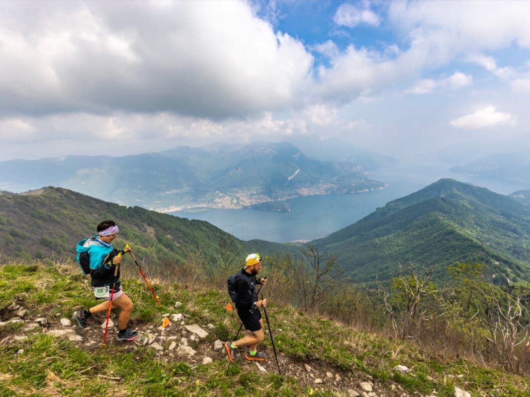
The Ultra Trail del Lago di Como (UTLAC) is a 254-kilometre alpine trail race held in early May, circumnavigating the entirety of Lake Como from its start in Lecco, Lombardy, Italy.
The course covers 254km with 12,430m of elevation gain — approximately 49m per kilometre — making it one of the most serious ultra-distance adventures in Europe. Entry for the 2026 edition was €535, or €2.11 per kilometre.
The course is run entirely in self-navigation mode: no route-marking, GPS required. Terrain is sharp alpine limestone across the high Lario and Larian Triangle, significantly more technical and unforgiving than most European ultras, particularly in wet conditions. The biggest climb arrives at km 110: 8.16km averaging 19.5% gradient with a peak of 32.6%. A challenging near-finish descent — approximately 1000 meters descending in 5.4km — will kill your heels with just 12km remaining.
Milan airports (MXP, LIN, BGY) are each approximately 60–70 minutes from Lecco. Founded in 2022, UTLAC completed its 2026 edition with 68 finishers on the 254km distance, drawn from 47 nations. It suits highly experienced ultra runners comfortable with self-navigation, extreme mountain terrain, and multi-day conditions.
How Hard Is UTLAC 254km? (Top1Descent Rank 14 of ~390 — 1,622m Drop at Halfway / Top1Ascent Rank 21 — Both Cruxes Strike at km 110–130)
Q: How hard is UTLAC 254km? A: Among the most extreme combinations of distance and gradient crux intensity in the DTR database. Top1Descent ranks 14th of ~390 (only 13 bigger drops; 1,622m / 9.6km / -16.9% avg) and Top1Ascent ranks 21st (only 20 bigger rises; 1,592m / 8.16km / 19.5% avg) — both occurring in the same 20km window at the race's halfway mark (km 110–130). 14.04km of uphill at 20%+ gradient. Descent 2 (-18.6% avg / -36.8% max) arrives at km 242 with <12km remaining. Total: 12,430m D+ over 254km (48.9 m/km — D+/km rank 213, below mid-database due to distance dilution). AvgUphill rank 207 (11.72% DW — mid-database; the near-mid average masks the extreme crux sections). AvgDownhill rank 186 inverted (steeper 52%; -11.63% DW). 68 finishers in 2025 and 2026. Self-navigation mode. Completion window: 43–50+ hours for finishers.
Course Profile — Lake Como Circumnavigation: The km 110–130 Crux Sequence, Descent 2 at km 242 (-18.6% Avg), 14km at 20%+ Uphill, Self-Navigation Mode
Q: What is the course route and format for UTLAC 254km? A: A circumnavigation of Lake Como starting and finishing in Lecco, traversing the trails of the High Lario and Larian Triangle — the mountain ranges surrounding Lake Como on the east and west. The route passes through Como lakeshore villages (Menaggio, Bellagio, Varenna, and others), ascending to mountain ridges via Italian jagged limestone/rock terrain. The course is officially described as covering "the most spectacular trails of the High Lario and the Larian Triangle." Key structural points: opening climbing begins early; the km 110–130 crux (Climb 1 + Descent 1 together — the database's top 21 + top 14) is the race's physical and psychological pivot; late-race Descent 2 at km 242 is the most technically savage section by gradient. 2026 winner: Aleš Frlic, 43:34:11. Women's: Lisa Borzani, 49:34:39. Event also offers 120km, 62.5km, 30km distances.
Entry, Cost, and Scale: €535/~€2.11/km, 68 Finishers, Self-Navigation, Not Sold Out — UTLAC 254km vs 120km vs 62.5km
Q: What is self-navigation mode in UTLAC 254km? A: The 254km distance is run in self-navigation mode — runners are responsible for their own route-finding and are not simply following a fully-marked course. This is a significant distinguishing feature vs. most European ultra-trail races where marking is comprehensive. Paradoxically, runner accounts from the 2023 edition describe UTLAC's course marking with bright blue ribbons as "among the best-marked trails" they had encountered — and the race director has proactively rerouted certain sections for safety. Whether self-navigation applies strictly to GPS navigation (requiring runners to carry a loaded device and navigate by track) or whether it refers to the absence of comprehensive physical marking, or both, is unclear from available sources. For the 120km and 62.5km distances, whether self-nav applies has not been confirmed in research.
Gradient Detail: AvgUphill Rank 207 (11.72% DW / 14.04km at 20%+), AvgDownhill Rank 186 Inverted (-11.63% DW), D+/km Rank 213 (48.9 m/km)
Q: What does UTLAC 254km cost and who typically finishes it? A: €535 standard registration fee (~€2.11/km). Price increased after April 1, 2026 — confirm current price at wedosport.net. No service fees charged on top. Not sold out. 68 finishers in both 2025 and 2026; 60 in 2024 (Airtable) — small specialist field in a ~1,800-runner festival event. UTMB Index 2024 lists 78 classified finishers (discrepancy vs Airtable 60 unresolved). The 254km attracts a specialist field: 47 nations represented in 2026; international podiums featuring top Italian runners (Daniele Nava, 2024), Slovenians (Aleš Frlic, 2026), and Spanish women (Silvia Trigueros Garrote, 2024). The race has grown from 2022 inaugural with an improving competitive field and growing international participation each year.
Race files
Logistics
Nearest airport
Milan Malpensa (MXP) / Milan Linate (LIN) / Milan Bergamo (BGY)
Notes
Start: ~1–2 hrs / Public transport: Good to Como/Lecco by train but race-start logistics depend on distance; car helpful / Accommodation: Very strong (Como/Lecco/Bellagio area) but can be expensive