SLOVAQUIE · Žilina Region (Malá Fatra / Terchová)
Malofatranská stovka MF100 — 107km, Chains and Ladders, and 9.7% Flat Through Slovakia's Malá Fatra
Informations clés
Distance
107 km
Date
Droit d’inscription
107 EUR
€ / km
€1.00
Nouvelle date en attente
Cette course a déjà eu lieu. La date de la prochaine édition est en attente.
Slovakia’s mountain traverse: long climbs, wild ridges, and a hard-earned finish in the Mala Fatra.
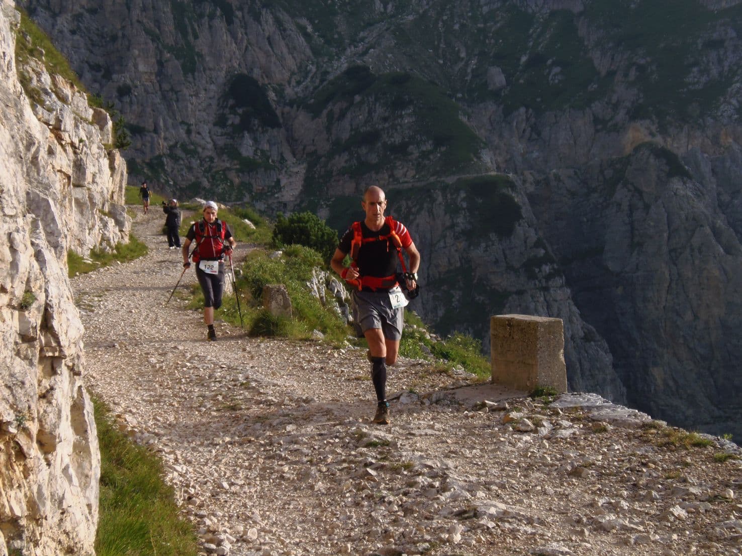
Malofatranská stovka MF100 runs 106.64km point-to-point from Terchová to Fačkov through Malá Fatra National Park in western Slovakia along the Malofatranská magistrála ridgeline. With only 9.7% flat terrain, the course is almost entirely climbing or descending: the distance-weighted average uphill gradient of 14.98% ranks 80th of ~390 GPX-tracked courses in the DTR database (top 21% steepest), and the -15.78% average downhill ranks 337th of ~390 on the inverted scale — one of the steepest average descents in the database. Multiple sections require fixed chains and ladders on exposed rocky terrain; the 66.91% maximum gradient on Climb 2 marks a chain-assisted near-vertical passage. Top single descent: 1,040m drop, rank 18/~390 — top 5% by absolute fall across all DTR-tracked courses. The late-race combination is defining: Climb 3 (692m / 14.51% avg, km 92.76) transitions with a ~120m gap into Descent 2 (791m / -12.56% avg, km 97.41) — nearly 1,500m of vertical change in the final 10–14km. Approximately 49 finishers in 2024 and 2025 — one of the smallest 100km+ fields in Europe. 5 ITRA points. Sells out annually in spring. Next edition June 2027.
Élévation et Terrain
Mètres totaux
6,585m
D+/KM
61.7m/km
Pour référence, le Tor des Géants 330 km a 73 D+/km.
Pente montante moyenne
15%
Pente descendante moyenne
-15.8%
Distribution du gradient de montée
| 2–5% | 8.2 km | |
|---|---|---|
| 5–10% | 11.5 km | |
| 10–15% | 7.8 km | |
| 15–20% | 7.1 km | |
| 20%+ | 13.5 km |
Profil de parcours
AnalysedDétail du terrain
| 46.4% | Montée |
|---|---|
| 9.7% | Plat |
| 44% | Descente |
Terrain
Ascensions

Principales montées
| Rank | Length | Elevation gain | Start km | Average gradient | Max gradient |
|---|---|---|---|---|---|
| 1 | 7.8 km · 975 m gain starts km 56 · avg 12.5% · max 47.2% | ||||
| 2 | 6.4 km · 946 m gain starts km 18 · avg 14.9% · max 66.9% | ||||
| 3 | 4.8 km · 692 m gain starts km 93 · avg 14.5% · max 42.2% |
Principales descentes
| Rank | Length | Elevation drop | Start km | Average gradient | Max gradient |
|---|---|---|---|---|---|
| 1 | 8.2 km · 1040 m drop starts km 45 · avg -12.7% · max -56.8% | ||||
| 2 | 6.3 km · 791 m drop starts km 97 · avg -12.6% · max -46% | ||||
| 3 | 3.4 km · 620 m drop starts km 10 · avg -18% · max -54.8% |
Malofatranská stovka MF100 — 107km, Chains and Ladders, and 9.7% Flat Through Slovakia's Malá Fatra
What Makes the Malofatranská stovka MF100 Different — Chains, Ladders, and the 66.91% Max Gradient on the Second-Hardest Climb?▼
Q: What makes the Malofatranská stovka MF100 different — chains, ladders, and the 66.91% max gradient on the second-hardest climb? A: The MF100 is a technical alpine traverse, not merely a steep mountain ultra. Multiple sections feature fixed chains and ladders on exposed rocky terrain — the 66.91% maximum gradient on Climb 2 (946m / 14.88% avg / 6.36km, km 18.36) almost certainly marks a chain-assisted passage, and the -56.76% maximum on the early descent (km 10.29) is similarly consistent with fixed-rope terrain. At 66.91%, the gradient approaches near-vertical scramble — far beyond what poles alone can assist. The race earns 5 ITRA points and carries a 14.98% distance-weighted average uphill gradient (rank 80/~390 — top 21% steepest in the DTR database), exceeding UTCAM 120km (14.7%). With only 9.7% flat terrain (~10.3km in 106.64km), runners have almost no simple ground between technical passages: 90.3% of the course is in active uphill or downhill gradient at virtually all times. The top single descent ranks 18/~390 — only 17 of ~390 GPX-tracked courses have a bigger absolute drop.
How Does the MF100 Course Profile Work — Top Descent Rank 18/~390, a Late Back-to-Back at km 92, and Only 9.7% Flat in 107km?▼
Q: How does the MF100 course profile work — top descent rank 18/~390, a late back-to-back at km 92, and only 9.7% flat in 107km? A: The MF100 runs point-to-point from Terchová to Fačkov through Malá Fatra National Park. The course opens with its steepest-average descent (km 10.29, 620m / -18.0% avg / -56.76% max), then climbs 946m at 14.88% average starting at km 18.36 (the second-ranked ascent, featuring the 66.91% max gradient). The biggest single descent (1,040m / -12.69% avg, rank 18/~390 — top 5% by absolute drop) begins at km 45.12, followed by the biggest climb (975m / 12.45% avg / 7.83km, rank 101/~390) starting at km 56.46. The defining structure arrives at the end: Climb 3 (692m / 14.51% avg / 4.77km) begins at km 92.76 and transitions immediately into Descent 2 (791m / -12.56% avg / 6.30km) at km 97.41 — only a ~120m gap between them. Nearly 1,500m of vertical change in the final 10–14km. With only 9.7% flat throughout, no easy running exists at any stage to compensate.
What Kind of Runner Does the Malofatranská stovka MF100 Suit — and How to Train for Chains, Ladders, and 14.98% Average Gradient?▼
Q: What kind of runner does the Malofatranská stovka MF100 suit — and how to train for chains, ladders, and 14.98% average gradient? A: The MF100 requires technical competence beyond standard 100km mountain ultra fitness. Chains and ladders mean the race is not safely completable on trail running skill alone — runners must be comfortable on exposed rocky ridgelines and capable of using fixed-rope assistance on near-vertical terrain. Training: include specific scramble practice on exposed rocky terrain; replicate back-to-back efforts arriving at Climb 2 (14.88% avg over 6.36km) on fatigued legs; train descent technique on -16% to -18% grade over sustained distances. The 14.98% DW avg uphill (rank 80/~390 — top 21% steepest) and -15.78% DW avg downhill (rank 337/~390 inverted — near steepest in the database) both demand training at the upper end of typical mountain programs. The late back-to-back (Climb 3 at km 92.76 into Descent 2 at km 97.41 with a ~120m gap) demands specific late-race vertical conditioning — include long efforts finishing on steep terrain. Poles are essential; practice using them on technical terrain where grip and footing are the limiting factor.
Is the Malofatranská stovka MF100 Worth Entering — EUR 107 Entry, a ~49-Person Field, 5 ITRA Points, and Why It Sells Out in Spring?▼
Q: Is the Malofatranská stovka MF100 worth entering — EUR 107 entry, a ~49-person field, 5 ITRA points, and why it sells out in spring? A: At EUR 107 (~EUR 1.00/km), the MF100 offers exceptional value relative to its difficulty and ITRA rating. The ~49-person field [LOW CONFIDENCE] makes it one of the smallest 100km+ events in Europe — closer to a guided mountain day with an expert group than a mass-participation race. The 5 ITRA points rating is one of the highest for a Slovak ultra and serves as a qualifier for major international events. Annual sell-out (typically spring) confirms demand significantly exceeds field size; the race has a loyal returning community and growing international participation from Czech Republic, Poland, Hungary, Germany, and France. The point-to-point Terchová-to-Fačkov format through Malá Fatra National Park is unique in the Slovak ultra calendar. Top descent rank 18/~390 means this course has one of the largest absolute single descents in the DTR catalogue — for those who want extreme technicality in a tiny field, few races compare. Register early for 2027 and check mfstovka.eu for opening dates.
Fichiers de course
Logistique
Aéroport le plus proche
Žilina (ILZ) / Poprad-Tatry (TAT) / Kraków (KRK) / Bratislava (BTS)
Notes
Start: ~15–45 min (ILZ) or ~1.5–2.5 hrs (TAT/KRK) or ~2.5–3.5 hrs (BTS) to Malá Fatra start towns (often Terchová; TODO: verify) / Public transport: good trains/buses to Žilina then bus to Terchová; doable without car / Accommodation: limited in Terchová/Vrátná; book early (summer)