Skip to content
Wien Rundumadum 42 km trail running route — Austria · Vienna

AUTRICHE · Vienna

Wien Rundumadum 42km: One of Europe's Flattest Urban-Forest Ultras — D+/km Rank 364 of 390, 57.8% Flat, 42km Through the Vienna Wienerwald

Distance

42 km

Date

Droit d’inscription

90 EUR

€ / km

€2.14

📅

Nouvelle date en attente

Cette course a déjà eu lieu. La date de la prochaine édition est en attente.

A 24/7 city-edge ultra: Vienna’s greenbelt looped into a gritty, urban-to-forest endurance test.

Wien Rundumadum 42km is the shortest individual race at Vienna's multi-distance forest and urban ultra festival — a 42km circuit through the Wienerwald greenbelt and Vienna's urban fringe starting from Sportcenter Donaucity. With 250m D+ over 42km (5.95m per kilometre), D+/km ranks 364th of 390 European trail races: only 26 races in the database carry less elevation per kilometre. Percent-flat at 57.8% (rank 361/390): 360 races are more mountainous; only 29 are flatter. The challenge is not altitude but sustained distance — 42km of forest path and city-edge trail at near-road-race gradient, with no significant climb to define the effort. Entry is €90 early bird (through May 31) or €110 standard, plus a mandatory GPS tracker rental of €15 paid in cash at check-in. Not sold out. The 2026 race date was July 11; register early for the 2027 edition. Vienna International Airport (VIE) is approximately 23 minutes from the race venue — no car required. Public transport in Vienna is excellent and accommodation world-class. The festival also offers 61km, 88km, and 130km distances.

Élévation et Terrain

Mètres totaux

250m

D+/KM

6.0m/km

Pour référence, le Tor des Géants 330 km a 73 D+/km.

Pente montante moyenne

5.2%

Pente descendante moyenne

-5%

Distribution du gradient de montée

Wien Rundumadum 42 km — uphill gradient distribution (GPX-derived, analysed 2026-05-02)
2–5%
5 km
5–10%
2.9 km
10–15%
0.8 km
15–20%
0 km

Profil de parcours

Analysed

Détail du terrain

Wien Rundumadum 42 km — terrain breakdown (GPX-derived, analysed 2026-05-02)
20.8%Montée
57.8%Plat
21.4%Descente

Terrain

ForestUrban

Ascensions

Wien Rundumadum climbs and descents profile

Principales montées

Wien Rundumadum 42 km — top climbs (GPX-derived, analysed 2026-05-02)
1

3.8 km · 80 m gain

starts km 25 · avg 2.1% · max 12.8%

Principales descentes

Wien Rundumadum 42 km — top descents (GPX-derived, analysed 2026-05-02)
1

4.7 km · 69 m drop

starts km 28 · avg -1.5% · max -18.5%

Wien Rundumadum 42km: One of Europe's Flattest Urban-Forest Ultras — D+/km Rank 364 of 390, 57.8% Flat, 42km Through the Vienna Wienerwald

Course Profile: 42km / 250m D+ at 5.95m per Kilometre — Ranked 364th of 390 European Trail Races for Vertical Density

Q: What is the course profile of Wien Rundumadum 42km? A: Wien Rundumadum 42km covers 42km with 250m D+ (GPX-verified; official figure flagged for verification). D+/km is 5.95m — ranking 364th of 390 European trail races for climbing density: only 26 races carry less elevation per kilometre. The course runs through Vienna's Wienerwald greenbelt and urban fringe from Sportcenter Donaucity. Terrain: Forest and Urban — a mix of forest paths, city-edge trail, and paved sections. Percent-flat: 57.8% (rank 361/390 — 360 races are more mountainous; 29 are flatter). The biggest single ascent rises 80m at +2.13% average gradient, beginning around km 24.84 (rank 357/390). The biggest single descent drops 69m at -1.49% average gradient from around km 27.93 (rank 365/390). Average uphill gradient: 5.23% (rank 364/390). Average downhill gradient: -5.01% (rank 26/390 on the inverted scale — 26th gentlest). Verify the 2027 course format at wien-rundumadum.at/bewerbe/42-km-einzel/.

The Rankings in Full: D+/km Rank 364, Percent-Flat Rank 361, Avg Uphill Rank 364 — What the Data Says About How Flat Wien Rundumadum 42km Really Is

Q: How does Wien Rundumadum 42km rank among European trail races for difficulty? A: Among 390 European trail races, Wien Rundumadum 42km ranks near the very bottom for elevation metrics. D+/km: 364/390 at 5.95m per km (363 races more vertical; only 26 less vertical). Percent-flat: 361/390 at 57.8% (360 more mountainous; 29 flatter). Average uphill gradient: 364/390 at 5.23% (363 steeper; only 26 gentler). Top single ascent: 357/390 at 80m rise. Top single descent: 365/390 at 69m drop. Average downhill gradient: 26/390 inverted (rank 1 = gentlest) — 25 races are gentler on average descent; 364 are steeper. By every metric this is one of the flattest European ultra-distance trail races. The difficulty is not elevation: it is sustaining 42km of continuous aerobic effort with no steep sections to break up the rhythm.

GPS Tracker Mandatory, €90 Early Entry — What Wien Rundumadum 42km Costs and What You Must Bring to Check-In

Q: What does it cost to enter Wien Rundumadum 42km and what is the GPS tracker requirement? A: Entry for Wien Rundumadum 42km runs €90 early bird (January 1 to May 31) and €110 standard (June 6 to November 1). Late registration on site adds a further €20 if slots remain. A GPS tracker rental of €15 is mandatory for all participants and is NOT included in the entry fee — it must be paid in cash at check-in. No GPS tracker payment = no race start. Arrive with €15 in cash ready. AUTO €/km: approximately €2.14 at early bird rate (€90 / 42km). The race is not sold out. The 2026 edition was July 11, 2026 (past). Check wien-rundumadum.at for 2027 registration dates and pricing.

The Wien Rundumadum Concept: Running 42km of Vienna's Wienerwald Greenbelt, Urban Fringe, and Forest Paths Around Austria's Capital

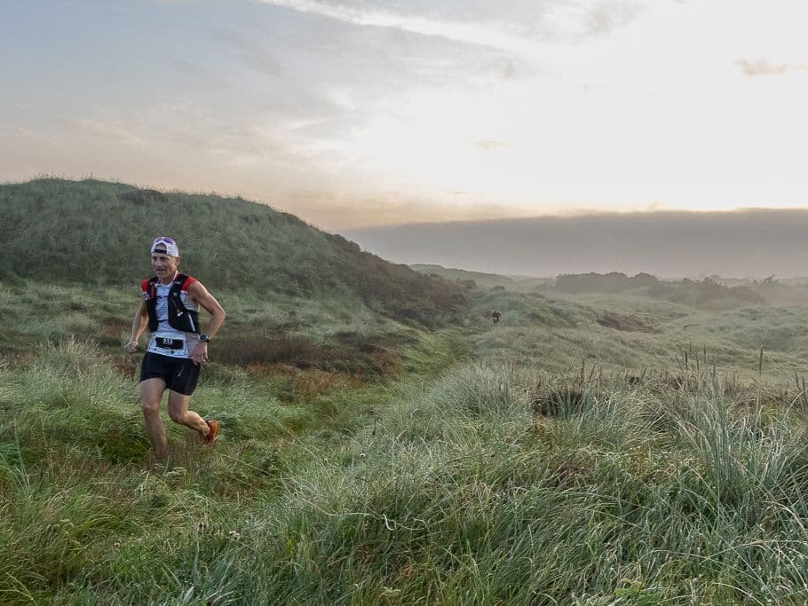
Q: What is the course setting and terrain of Wien Rundumadum 42km? A: Wien Rundumadum 42km runs through the Wienerwald — Vienna's greenbelt forest — and the urban fringe of Austria's capital. The terrain is classified as Forest and Urban: well-maintained forest paths, city-edge trails, and paved sections through Vienna's outer districts. The race is named Rundumadum (around and around) — the full 130km distance completes a full circuit of Vienna, with the 42km, 61km, and 88km distances covering portions of the same loop. Start and finish: Sportcenter Donaucity. Vienna is a UNESCO World Heritage city and one of Europe's premier destinations — the surroundings make for a distinctive race backdrop. The Wienerwald forest paths are well-maintained, runnable, and non-technical, consistent with the race ranking 364/390 for average uphill gradient.

Fichiers de course

Logistique

Aéroport le plus proche

Vienna (VIE)

Notes

Start: ~20–45 min to central Vienna / Public transport: excellent / Accommodation: very strong; easy logistics

Dernière vérification : February 19, 2026Site officiel →

Courses avec un gradient similaire