Skip to content
Transruinaulta 42K 42.2 km trail running route — Switzerland · Graubünden

SUISSE · Graubünden

Transruinaulta 42K: Running Switzerland's Rhine Gorge, Measured

Distance

42 km

Date

Droit d’inscription

95 CHF

€ / km

€2.45

Swiss canyon runway: fast trails along the Rhine gorge with stunning cliffs and easy logistics.

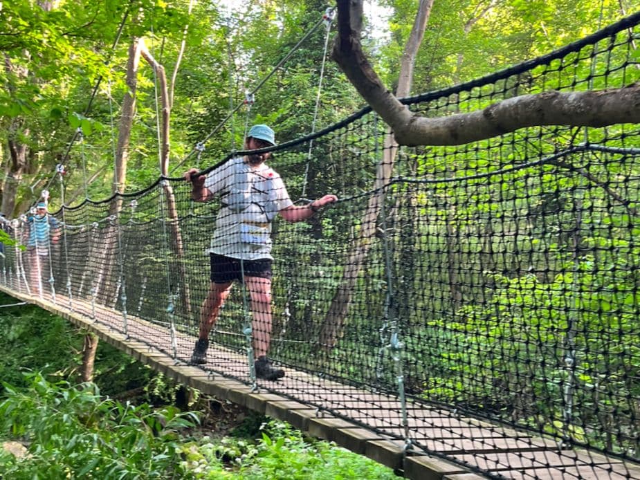
Transruinaulta 42K is a 42.2 km trail race held in October in Graubünden, Switzerland, following the Rhine Gorge (Ruinaulta) point-to-point from Ilanz to Thusis. The course gains 1,800 m (42.7 m/km) and is weighted toward descent — 40% of the course is downhill versus 37.2% uphill — rewarding runnable pacing on technical canyon singletrack: wooden footbridges over the Rhine, steep rock faces, dense gorge forest, and a sustained gradient character throughout. The biggest climb rises 350m over 3.03km at 11.55% average (km 24.66). The final descent drops 412m over 4.83km after km 31. Aid stations serve Swiss specialties — birabrot, biberli, and local cheese. October in the gorge is typically cool and possibly rainy. Entry costs €2.45/km — near the premium end of the European trail market for this distance. Zürich (ZRH) is approximately 115 minutes by public transport. The 42km connects with the Transviamala (19km, day 2) as a two-day stage race for CHF 175. Now in its 22nd edition (2026), Transruinaulta suits technically competent trail runners who want a scenically exceptional alpine gorge route — and the option to turn one race into a Swiss trail weekend.

Élévation et Terrain

Mètres totaux

1,800m

D+/KM

42.7m/km

Pour référence, le Tor des Géants 330 km a 73 D+/km.

Pente montante moyenne

11.6%

Pente descendante moyenne

-10.5%

Distribution du gradient de montée

Transruinaulta 42K 42 km — uphill gradient distribution (GPX-derived, analysed 2026-05-02)
2–5%
3.2 km
5–10%
4.1 km
10–15%
5.2 km
15–20%
2 km
20%+
1.4 km

Profil de parcours

Analysed

Détail du terrain

Transruinaulta 42K 42 km — terrain breakdown (GPX-derived, analysed 2026-05-02)
37.2%Montée
22.8%Plat
40%Descente

Terrain

Canyon

Ascensions

Transruinaulta 42K climbs and descents profile

Principales montées

Transruinaulta 42K 42 km — top climbs (GPX-derived, analysed 2026-05-02)
1

3 km · 350 m gain

starts km 25 · avg 11.6% · max 20.1%

2

2.9 km · 222 m gain

starts km 17 · avg 7.8% · max 19.7%

3

1.7 km · 215 m gain

starts km 29 · avg 12.8% · max 21.3%

Principales descentes

Transruinaulta 42K 42 km — top descents (GPX-derived, analysed 2026-05-02)
1

4.8 km · 412 m drop

starts km 31 · avg -8.5% · max -23.2%

2

3.4 km · 340 m drop

starts km 21 · avg -10% · max -33.5%

3

2.6 km · 200 m drop

starts km 15 · avg -8% · max -44.2%

Transruinaulta 42K: Running Switzerland's Rhine Gorge, Measured

What Makes Transruinaulta Different from Every Other Swiss Trail Race?

Q: How hard is the Transruinaulta 42K? A: Moderate. At 42.7m/km and 22.8% flat terrain, the gradient profile is challenging but not extreme — comparable in elevation density to Les Templiers Grand Trail. The course leans net-descent (40% downhill), rewarding runners who pace the canyon climbs well. The technical character of the gorge trail and sustained gradient mean there are no easy kilometres.

Course Profile — Canyon Singletrack, Wooden Bridges, and a Net Descent to Thusis

Q: Can I combine Transruinaulta with another race? A: Yes. The Transviamala (19km, Thusis-based) runs the following day and can be entered as a two-day stage race with the 42km for CHF 175 total.

€2.45 per Kilometre — What Swiss Canyon Organisation Costs

Q: How much does it cost to enter Transruinaulta 42K? A: CHF 95 standard entry — €2.45 per kilometre — placing it near the premium end of the European trail market for a 42km race. Swiss operational costs and 22 years of race infrastructure are reflected in the price.

Getting There: Zürich, the RhB Train, and Why Ilanz Is Easier to Reach Than Most Alpine Starts

Q: When does the 2026 Transruinaulta take place? A: October 24, 2026.

Fichiers de course

Logistique

Aéroport le plus proche

Zürich (ZRH)

Notes

Start: ~2–2.75 hrs to Ilanz by train+bus / Public transport: good (rail to Chur + RhB to Ilanz) / Accommodation: moderate in Ilanz/Flims/Laax; book early (summer)

Dernière vérification : February 19, 2026Site officiel →

Courses avec un gradient similaire