Skip to content
Sörmlands Trail Run – 100 km 2026 trail running route — Sweden · Södermanland County

Sweden · Södermanland County

Distance

100 km

Date

Entry fee

SEK 1,650

€ / km

€1.57

Sörmlands Trail Run 100km: Sweden's Flattest Big Trail Ultra

The Sörmlands Trail Run 100km is a point-to-point trail race held each September in Södermanland County, Sweden, running from Öster Malma castle to the coastal village of Nävekvarn. The course covers 100km with 1,300m of total elevation gain — just 13m per kilometre — making it one of the fifteen least elevation-dense distances in DTR's database of nearly 390 courses. Entry for the 2026 edition is 1,850 SEK (€1.57 per kilometre at early-bird pricing).

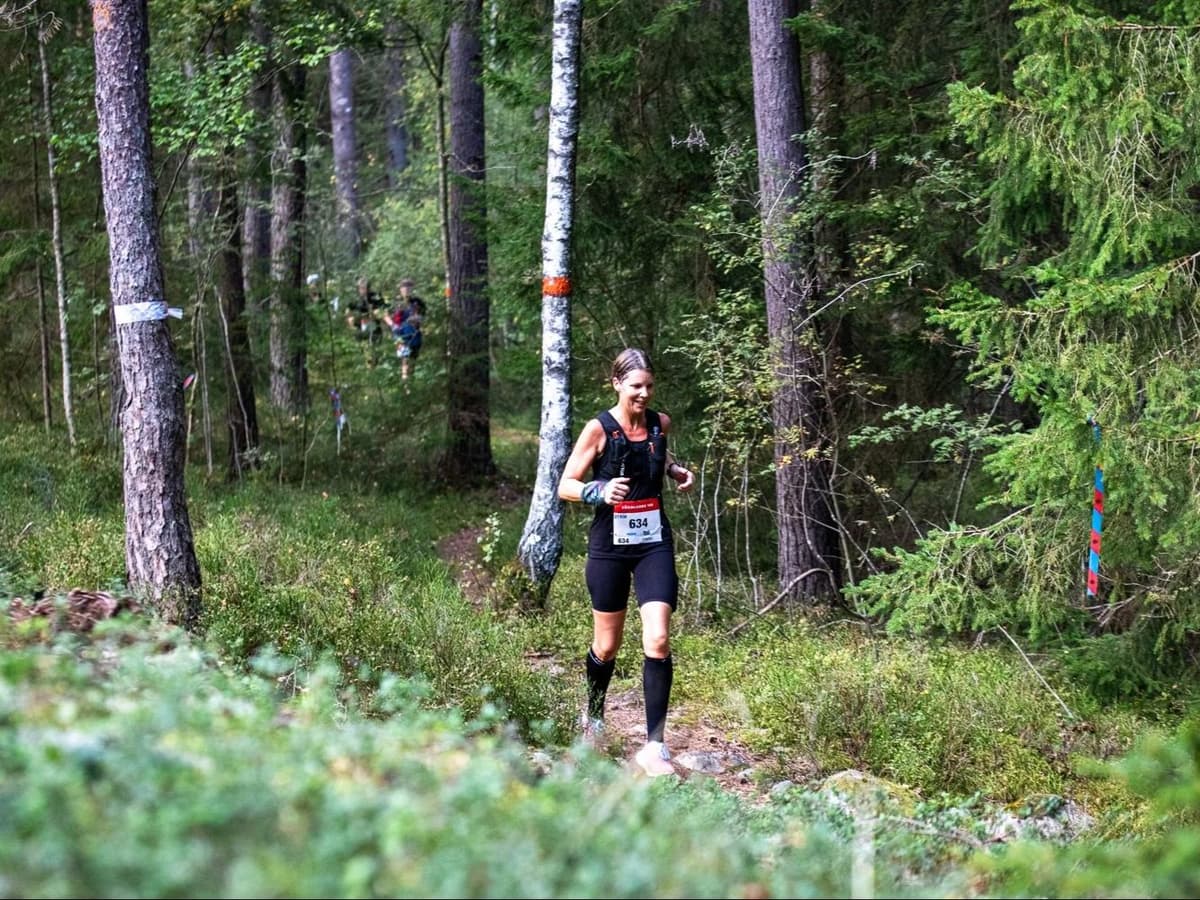
The Sörmlands Trail Run course runs 65% trail, 25% gravel, and 10% asphalt through Sörmland's rolling forest, farmland, and lakeside trails. With 58% of the course classified as flat terrain and an average uphill gradient of just 5.3%, this is one of the most runnable 100km trail ultras in Europe by the numbers. The defining feature is the aid stations: placed at some of the region's best local restaurants and food producers, a direct result of race director Billy White's background as a chef and author. Stockholm Skavsta Airport (NYO) is 13 minutes from the Nyköping race base.

The race suits road runners making their trail ultra debut, fast-hikers targeting a runnable distance, and anyone who wants a genuine point-to-point Swedish forest adventure without technical mountain terrain.

Elevation and Terrain

Total Meters

1,300m

D+/KM

13.0m/km

For context, the Tor des Géants 330 loop has 73 D+/km.

Avg Uphill Gradient

5.3%

Avg Downhill Gradient

-5.3%

Uphill gradient distribution

Sörmlands Trail Run – 100 km 100 km — uphill gradient distribution (GPX-derived, analysed 2026-05-02)
2–5%
13.1 km
5–10%
6.7 km
10–15%
1.6 km
15–20%
0.4 km
20%+
0.2 km

Route Profile

Analysed

Terrain breakdown

Sörmlands Trail Run – 100 km 100 km — terrain breakdown (GPX-derived, analysed 2026-05-02)
20.6%Uphill
58.0%Flat
21.4%Downhill

Terrain

Forest

Sörmlands Trail Run – 100 km 100km Top Climbs

Top Climbs

Sörmlands Trail Run – 100 km 100 km — top climbs (GPX-derived, analysed 2026-05-02)
1

0.8 km · 43 m gain

starts km 61 · avg 5.8% · max 13.2%

2

2.1 km · 42 m gain

starts km 39 · avg 2.1% · max 11.9%

3

1.6 km · 40 m gain

starts km 1 · avg 2.6% · max 10.9%

Top descents

Sörmlands Trail Run – 100 km 100 km — top descents (GPX-derived, analysed 2026-05-02)
1

2.4 km · 59 m drop

starts km 101 · avg -2.4% · max -12.7%

2

3.1 km · 54 m drop

starts km 32 · avg -1.7% · max -22.3%

3

1.4 km · 37 m drop

starts km 6 · avg -3.0% · max -9.8%

Sörmlands Trail Run 100km: Sweden's Flattest Big Trail Ultra

How Flat is the Sörmlands Trail Run 100km Course?

How Flat is the Sörmlands Trail Run 100km Course?

It is exceptionally flat by ultra trail standards. Total elevation gain is 1,300m over 100km, just 13m per kilometre. Of the 389 distances in DTR's database with GPX data, only approximately 12 are less elevation-dense. Average uphill gradient is 5.33% and 58% of the course is flat terrain. The biggest single climb gains just 43m. Runners comfortable with road marathons or flat hiking can handle the gradient demands of this course.

How Much Does the Sörmlands Trail Run cost?

How Much Does the Sörmlands Trail Run cost?

Entry for the 2026 edition is tiered: 1,650 SEK (November 2025–February 2026), 1,850 SEK (March–May 2026), and 2,050 SEK (June–September 2026). At mid-tier pricing that's approximately €165–175 depending on exchange rate, or roughly €1.57 per kilometre based on early-bird pricing.

Nearest Airports and Travel Options for Sormlands Trail Run 100KM

How do you get to the Sörmlands Trail Run?

The race starts at Öster Malma castle near Nyköping. Stockholm Skavsta Airport (NYO) is just 13 minutes by car, it is one of the most accessible race starts in Scandinavian trail running. Wizzair flies into NYO from Warsaw, Bucharest, and Belgrade; Norwegian flies seasonally from Spain. Stockholm Arlanda (ARN) is also an option, with train and bus connections to Nyköping taking approximately 2 hours. Nyköping also offers multiple options to choose from when it comes accommodations.

What to expect from the Sörmlands Trail Run 100km Course and Terrain.

What is the Sörmlands Trail Run route like?

A point-to-point course from Öster Malma castle through Sörmland's forest, farmland, and lakeside trails to the coastal village of Nävekvarn. Terrain is 65% trail, 25% gravel, and 10% asphalt. The route crosses five municipalities and over 120 private landholdings. Aid stations are placed at some of the region's most notable local restaurants and food producers.

Climate Guide: The Sörmlands Trail Run 100km Race

What is the weather like on September for Sormlands Trail Run 100km?

September in Nyköping is a mild early-autumn month. Conditions are noticeably cooler than summer but not cold. Potential rain increase as autumn approaches. With the race running at very low elevation, there is no altitude-related weather risk for this race.

Sörmlands Trail Run – 100 km 100km GPX

Getting to Sörmlands Trail Run – 100 km

Nearest airport

Stockholm Skavsta (NYO) / Stockholm Arlanda (ARN)

Notes

Start: Only 15 minutes by car or bus from NYO to Nyköping. Wizzair flies from Warsaw, Bucharest, Belgrade into NYO, Norwegian flies seasonally from Spain / Public transport: train/bus/car from ARN to Nyköping/Trosa region takes about two hours / Accommodation: Nyköping is the best base with plentiful lodging, and is a stop on the shuttle bus to race starts, as well as the start of the 50km race. Airbnbs available at race finish and other towns nearby (car recommended)

Last checked: Official Website →

Races with a similar gradient