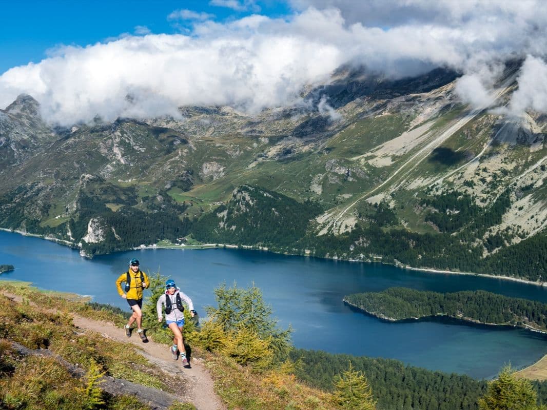
Switzerland · Canton Grisons (Upper Engadine)
Distance
102 km
Date
Entry fee
CHF 150
€ / km
€1.60
Engadin Ultra Trail 101.9km: Switzerland's Upper Engadine Night Race — 10.9% Flat, 2,818m High Point, and Almost No Recovery Terrain
Engadin Ultra Trail 101.9km (EUT102) is an alpine night race through Switzerland's Upper and Lower Engadine, starting at 23:00 on July 17, 2026, from Samedan. The course gains 5,677m over 101.9km (55.7 m/km) between Zuoz and Samedan, reaching a high point of 2,818m at Fuorcla Val Champagna. Only 10.9% of the course is flat — the remaining 89.1% is uphill or downhill, making this one of the least forgiving gradient profiles of any 100km+ race in the DTR database. Distance-weighted average gradients are 12.9% uphill and 13% downhill; the descent is marginally steeper than the climb.
The primary descent drops 1,120m over 6.9km at 16.2% average, arriving at km 34. Entry costs CHF 160 (€1.71/km per DTR's AUTO calculation); processing fees may apply via the payment platform. Not sold out for 2026. 26-hour time limit; 9 aid stations. Zürich ZRH and Milan MXP are the primary airports at 216 min; the race is classified IS FAR, though Samedan has rail access. First held in 2021 — 6th edition in 2026, with 35 finishers in 2025. Suits experienced alpine runners comfortable with 2,800m altitude, steep descents, a cold night start, and almost no flat recovery terrain.
Elevation and Terrain
Total Meters
5,677m
D+/KM
55.7m/km
For context, the Tor des Géants 330 loop has 73 D+/km.
Avg Uphill Gradient
12.9%
Avg Downhill Gradient
-13.0%
Uphill gradient distribution
| 2–5% | 6.7 km | |
|---|---|---|
| 5–10% | 10.4 km | |
| 10–15% | 13.5 km | |
| 15–20% | 7.1 km | |
| 20%+ | 7.9 km |
Route Profile
AnalysedTerrain breakdown
| 44.7% | Uphill |
|---|---|
| 10.9% | Flat |
| 44.4% | Downhill |
Terrain
Engadin Ultra Trail – 101.9 km 102km Top Climbs
Top Climbs
| 1 | 7.6 km · 1,073 m gain starts km 27 · avg 14.1% · max 33.8% |
|---|---|
| 2 | 7.1 km · 927 m gain starts km 64 · avg 13.0% · max 32.1% |
| 3 | 7.7 km · 828 m gain starts km 0 · avg 10.7% · max 27.1% |
Top descents
| 1 | 6.9 km · 1,120 m drop starts km 35 · avg -16.2% · max -41.1% |
|---|---|
| 2 | 9.7 km · 815 m drop starts km 7 · avg -8.4% · max -27.4% |
| 3 | 7.6 km · 782 m drop starts km 94 · avg -10.0% · max -33.0% |
Swiss High-Alpine Terrain and the Full Technical Demands of EUT 101.9km
How hard is the Engadin Ultra Trail 101.9km?
▼
Very hard. The course covers 101.9km with 5,677m of gain (~55.7m/km), reaching 2,818m at Fuorcla Val Champagna. Only 10.9% of the course is flat — 89% is either climbing or descending. Distance-weighted average gradients are 12.89% uphill and 13.02% downhill (the descent is marginally steeper than the climb). 26-hour time limit; 9 aid stations. Night start at 23:00 adds cold alpine conditions from the gun.
What is the highest point on the Engadin Ultra Trail?
What is the highest point on the Engadin Ultra Trail?▼
The highest point is Fuorcla Val Champagna at 2,818m — an alpine col with views over Lake Muragl and Piz de las Sterlas. Most runners will cross this point in the early morning hours after the 23:00 start. Sub-zero temperatures at altitude are possible even in July; mandatory gear should include insulation layers.
€1.71/km for a Swiss Alpine Night 100km: What the Engadin Ultra Trail Costs (Including Processing Fees)
How much does the Engadin Ultra Trail 101.9km cost?
▼
The standard entry fee is CHF 160 (approximately €1.71/km per DTR's AUTO calculation). The payment platform may charge additional processing fees beyond the CHF 160 standard. Bib transfer and distance downgrade are both available until July 17, 2026. Registration is open and not sold out for 2026.
Getting to the Engadin Ultra Trail: IS FAR Despite Zürich (ZRH) — and Why the Train to Samedan Changes the Calculation
How do I get to the Engadin Ultra Trail?
▼
Zürich ZRH and Milan MXP are both approximately 216 minutes from Samedan — the race is classified IS FAR. However, Samedan has direct rail access via the Rhaetian Railway (connecting through Chur from Zürich, or via Tirano from Milan), making this one of the few IS FAR races accessible without a rental car. Accommodation in the Engadine/St. Moritz area is excellent but expensive — book early.
Night Start from Samedan: The EUT102 Race Date and Alpine Conditions
What time does the Engadin Ultra Trail 101.9km start?
▼
The EUT102 starts at 23:00 on Friday, July 17, 2026, from Samedan, Switzerland. Runners cross the high point Fuorcla Val Champagna (2,818m) in alpine darkness. The finish line is open through July 18. The 26-hour time limit means strong runners finish before dawn; slower finishers complete the race in daylight.
Engadin Ultra Trail – 101.9 km 102km GPX
Getting to Engadin Ultra Trail – 101.9 km
Nearest airport
Zürich (ZRH) / Milan (MXP)
Notes
Start: ~3–4.5 hrs (ZRH) or ~3–4 hrs (MXP) by car; train to Samedan available / Public transport: good (train to Samedan) / Accommodation: strong in St. Moritz/Engadine but pricey; book early

FAR
It’ll possibly take 3+ hours from the closest large airport to arrive. Plan your adventure accordingly, take an extra day for those after-race beers or Curranz.