Finland · Lapland
Distance
66 km
Date
Entry fee
—
€ / km
—
NUTS Ylläs-Pallas 66km: Arctic Fell Ultra Through Pallas-Yllästunturi National Park Under the Midnight Sun
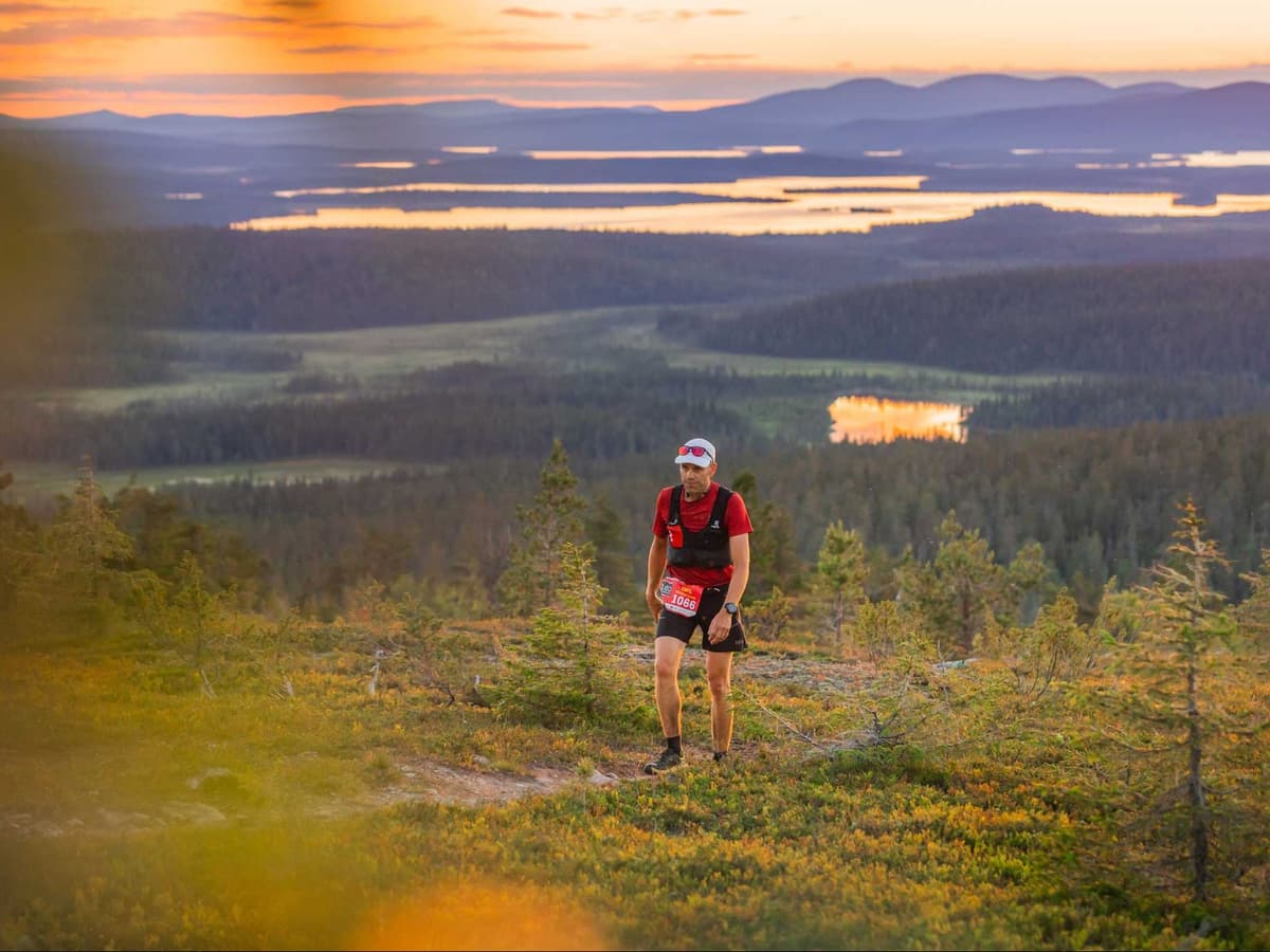
NUTS Ylläs-Pallas 66km is a point-to-point ultra through Pallas-Yllästunturi National Park in Finnish Lapland, the shortest of three distances at Finland's flagship Arctic fell-running festival. The course traverses open Arctic fells (tunturi) and spruce forests over 66km of primarily runnable singletrack, gaining 1,628m D+ — 24.7m per km. D+/km ranks 317th of 390 European ultras: the defining character here is accumulated fell distance and Arctic conditions, not technical gradient.
The race runs entirely under the Midnight Sun; above the Arctic Circle in July, runners experience full 24-hour daylight with no headlamp required for the entire distance. Entry is €152.90 (€2.32 per km); a 30% Zoomer Rebate applies for runners born in 2000 or later. Not sold out. A race bus serves the point-to-point start (€21–32). Nearest airport: Kittilä (KTT), 30 to 60 minutes away; the race is classified as FAR. Part of the Ultra Trail Tour Finland series. First held in 2014. 2026 race date: July 17.
Elevation and Terrain
Total Meters
1,628m
D+/KM
24.7m/km
For context, the Tor des Géants 330 loop has 73 D+/km.
Avg Uphill Gradient
8.4%
Avg Downhill Gradient
-7.5%
Uphill gradient distribution
| 2–5% | 7.4 km | |
|---|---|---|
| 5–10% | 6.5 km | |
| 10–15% | 4.7 km | |
| 15–20% | 2.0 km | |
| 20%+ | 0.5 km |
Route Profile
AnalysedTerrain breakdown
| 31.8% | Uphill |
|---|---|
| 35.8% | Flat |
| 32.4% | Downhill |
Terrain
NUTS Ylläs-Pallas – 66 km 66km Top Climbs
Top Climbs
| 1 | 5.1 km · 357 m gain starts km 12 · avg 7.0% · max 19.7% |
|---|---|
| 2 | 2.2 km · 302 m gain starts km 48 · avg 13.8% · max 23.7% |
| 3 | 2.4 km · 187 m gain starts km 60 · avg 7.8% · max 15.8% |
Top descents
| 1 | 3.4 km · 296 m drop starts km 63 · avg -8.8% · max -22.9% |
|---|---|
| 2 | 3.7 km · 289 m drop starts km 17 · avg -7.9% · max -19.3% |
| 3 | 2.2 km · 139 m drop starts km 46 · avg -6.0% · max -21.3% |
NUTS Ylläs-Pallas 66km: Course Profile, Elevation, and Distance Overview
How far is the NUTS Ylläs-Pallas 66km and what is the elevation gain?
▼
The NUTS Ylläs-Pallas 66km covers approximately 66km officially (66.14km by GPX analysis) with 1,628m D+ confirmed by both official figures and GPX measurement — no conflict. D+/km of approximately 24.7m ranks 317th of 390 European ultras, placing it among the lowest-relief European ultras in the database. The course traverses Arctic fell terrain through Pallas-Yllästunturi National Park with primarily runnable singletrack character. GPX D- is 1,747m, indicating a point-to-point course with approximately 119m net descent. The 2026 race takes place on July 17, 2026.
Point-to-Point Through Pallastunturi: The NUTS Ylläs-Pallas 66km Course Route
What is the course route of the NUTS Ylläs-Pallas 66km?
▼
The NUTS Ylläs-Pallas 66km runs point-to-point through Pallas-Yllästunturi National Park in Finnish Lapland — a protected wilderness area and one of Finland's most visited national parks. The course traverses open Arctic fells (tunturi) and sections of spruce forest, covering approximately 66km of primarily runnable singletrack. A race bus runs between start and finish (€21–32); check nutsyllaspallas.com for the confirmed 2026 start and finish locations. The 66km is the shortest of three NUTS Ylläs-Pallas distances (66km, 100km, 160km) run on the same event weekend.
Terrain and Gradient: Where NUTS Ylläs-Pallas 66km Ranks Among 390 European Ultras
What is the terrain like on the NUTS Ylläs-Pallas 66km?
▼
The NUTS 66km runs through Arctic fell terrain — open, rolling tunturi landscape at and above the treeline, with sections of spruce forest at lower elevations. With D+/km of 24.7m (ranking 317th of 390 European ultras) and average uphill gradient ranking 314th of 390, this is one of the most gradual climbing profiles in European ultra running. The average downhill gradient ranks 59th of 390 for gentleness, making descents exceptionally accessible by mountain-race standards. Approximately 19% of the course is nominally flat fell terrain. The challenge is accumulated endurance across runnable fell terrain under Arctic conditions — continuous, gradual, and relentless rather than technically steep.
Entry Fee, Zoomer Rebate, and Race Bus Logistics for the NUTS 66km
What is the entry fee for the NUTS Ylläs-Pallas 66km and is it sold out?
▼
The 2026 NUTS Ylläs-Pallas 66km entry fee is €152.90 (approximately €2.32/km). The race is not sold out. A 30% Zoomer Rebate applies for runners born in 2000 or later, reducing entry to approximately €107. A race bus to the point-to-point start costs €21 (booked before May 12) or €32 (after). Entries are non-refundable; category changes require paying the fee difference, with an additional change fee within two weeks of the event. Registration is at nutsyllaspallas.com.
Getting to NUTS Ylläs-Pallas: Kittilä Airport, Transfer Times, and Accommodation
How do I get to the NUTS Ylläs-Pallas 66km?
▼
The nearest airport is Kittilä (KTT), approximately 30 to 60 minutes from the Ylläs area. The race is classified as FAR — KTT is a small regional airport reachable via connecting flight through Helsinki or other hubs, making total travel time from most European cities substantially longer than three hours. Public transport (bus) is possible but a car is recommended for race logistics. Accommodation in the Ylläs ski resort area is well-supplied but books quickly in peak summer. The race bus (€21–32) is essential for managing point-to-point start logistics.
NUTS Ylläs-Pallas – 66 km 66km GPX
Getting to NUTS Ylläs-Pallas – 66 km
Nearest airport
Kittilä (KTT)
Notes
Start: ~30–60 min (Ylläs area) / Public transport: Possible (bus) but car easiest for race logistics / Accommodation: Very good (ski resort supply) but can fill in peak summer
FAR
It’ll possibly take 3+ hours from the closest large airport to arrive. Plan your adventure accordingly, take an extra day for those after-race beers or Curranz.